FIRST ALERT WEATHER DAY: Tornado Watch continues for parts of Central Texas!
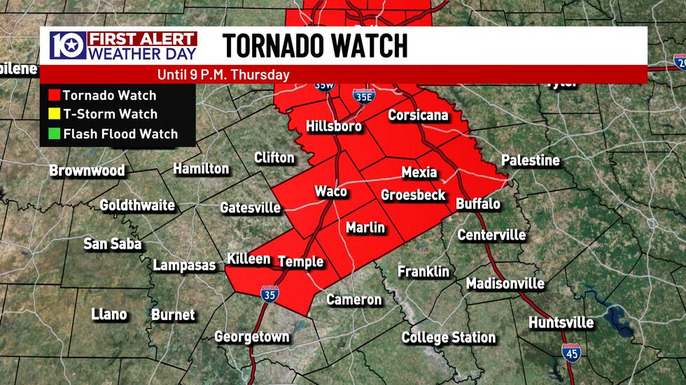
WACO, Texas (KWTX) - A Tornado Watch has been issued for the following counties of Central Texas until 9pm: McLennan, Bell, Hill, Falls, Limestone, and Freestone. The main threat from storms this afternoon and evening will be strong straight line winds and locally heavy rain, but a few isolated tornadoes can’t be ruled out.
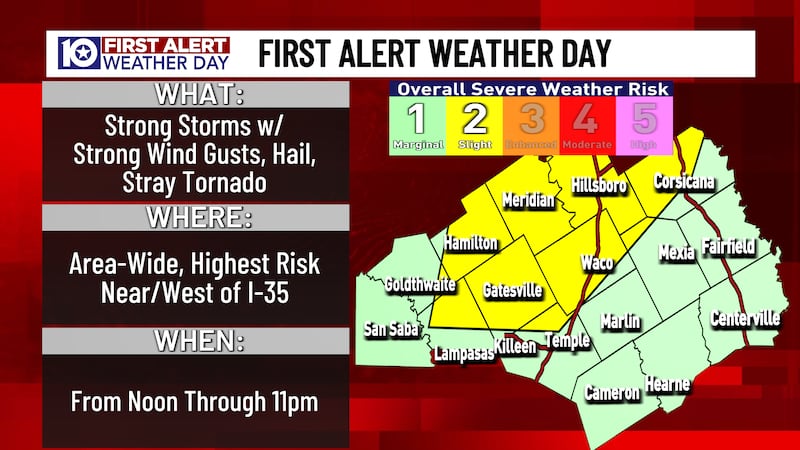
Scattered Storms Could Produce Severe Weather
An approaching upper level low pressure system will push a pacific cold front through Central Texas during the afternoon and evening hours. Scattered thunderstorms are likely develop along the front as it pushes through our area. There could also be a few isolated storms develop out in advance of the approaching front. Today is a day where we don’t expect widespread severe weather, but a few of these storms could become strong to severe.
The main severe weather concerns with these thunderstorms will be gusty winds and locally heavy rainfall. Some of the stronger storms could also produce hail up to half dollar size. The tornado threat isn‘t high, but it‘s a day where we can’t rule out an isolated tornado.
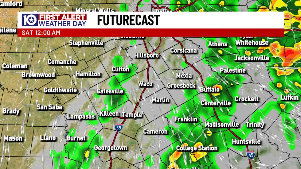
Your severe weather threat will diminish once the cold front moves through your area, but the potential for scattered showers and thunderstorms continues.
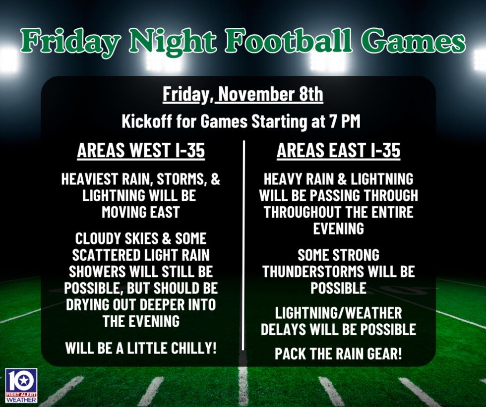
Storms could impact some area football games
Even if we don‘t see severe weather, thunderstorms could cause issues for some area football games this evening. It won’t rain at every game this evening, but I would pack the rain gear for any game that you are going to. Lightning will be the biggest concern at most games, as that will lead to some games being delayed. The biggest impacts will like be felt for games near and east of I-35, as these scattered storms will push east throughout the evening. For areas behind the cold front, you may want to pack a light jacket as well, because it will be notably cooler behind the front.
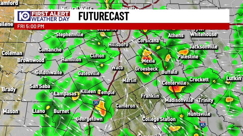
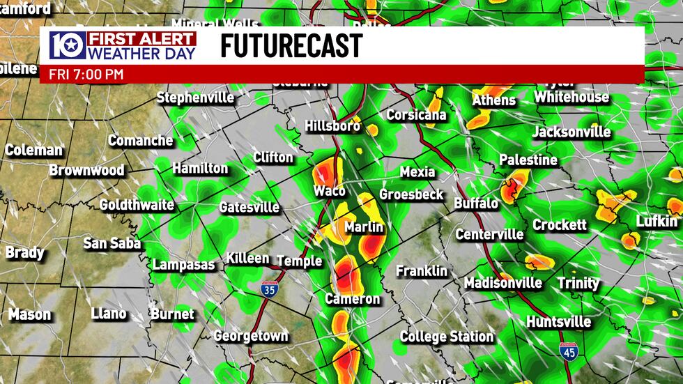
Latest timing of storms
The cold front that we are tracking has already moved through our western counties and is approaching the I-35 corridor. We anticipate the cold front to push across I-35 between 5-6pm. There is still the chance to see showers and thunderstorms behind the front, but the severe potential will be confined to areas in advance of the cold front.

Easy Way to Keep Up To Date With the Weather At Area Football Games
You can easily keep an eye on the radar at area games with our FREE KWTX WEATHER APP. Our weather team will also send out updated forecasts throughout the afternoon and evening to help you plan around the weather.
Copyright 2024 KWTX. All rights reserved.


