Back to More Seasonable Temperatures and Lots of Sunshine
Remember our old friend the omega block? Well it’s riding back into town and is going to keep us dry for a while. Both the rain and summer-like temperatures are looking to be a thing of the past as drier cooler air sets in.
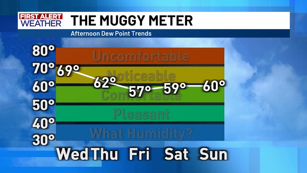
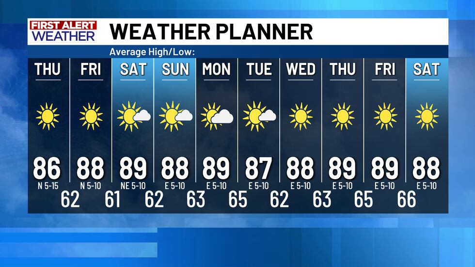
The winds out of the north on the back side of our early morning cold front will continue over the next few days and bring drier and drier air into our area. The cooler temperatures will be hanging around along with that drier air so we will be looking at more seasonable afternoon highs in the mid-upper 80s and early morning lows down in the lower 60s.
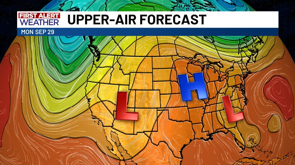
Over the next few days, as the upper level trough that spurred the system that brought us all that rain this morning shifts off to the east, an upper level high will take control across the central U.S. and be trapped between two low pressure troughs creating this omega block pattern once again. This pattern will keep us consistently dry and seasonably warm for a while outside of a small disturbance that appears to be moving through early next week but looks to do no more than give us some extra cloud cover.
Copyright 2025 KWTX. All rights reserved.


