Consistent Warm and Sunny Weather Ahead in Central Texas.
Concerns in the Tropics Continue to Grow.
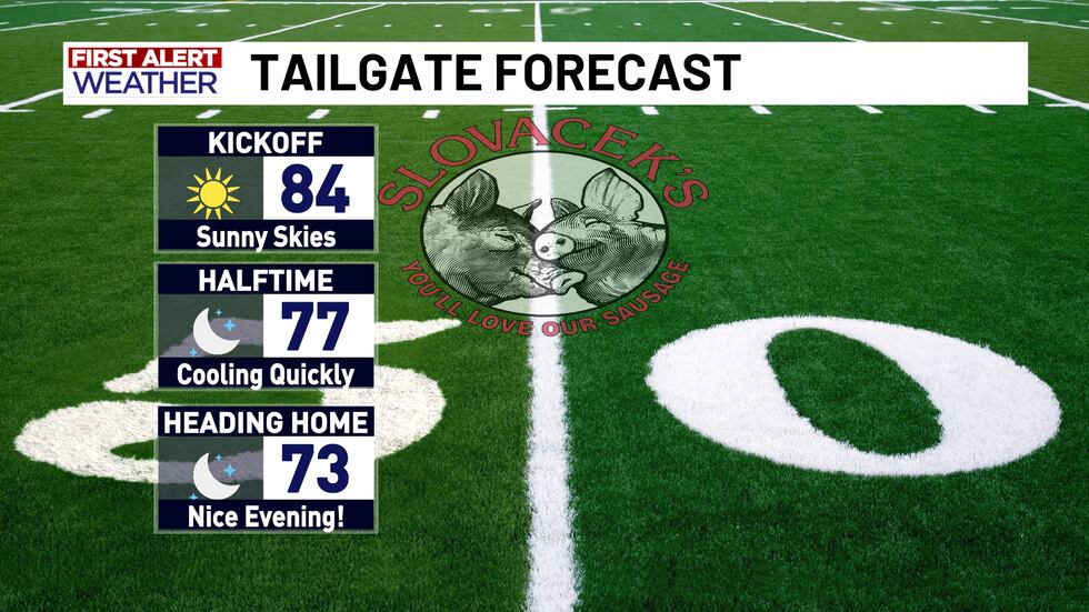
Looking to be a great evening to watch some football, as a matter of fact this will be our coolest evening of the football season so far… although this is more average for this time of year as opposed to all the heat we had the last few weeks. These cooler temperatures and drier air will be a consistent theme here across Central Texas, but other parts of the country are not so lucky as portions of the southeast are possibly in the line of fire of a developing tropical system.
Temperatures will be in the mid 80s at game time tonight and will be falling quickly after sunset. We are looking at lower 70s by the time the game is over and potentially in the upper 60s the farther west you are of I-35. Over the next couple of days we are looking at more of this pattern of highs around 90 and no chances for rainfall.
In the tropical Atlantic we are continuing to track Invest 94-L as it moves northward toward the Bahama islands. 94-L looks to be our next named storm of the 2025 season as it is likely to reach tropical storm status sometime within the next day or so.
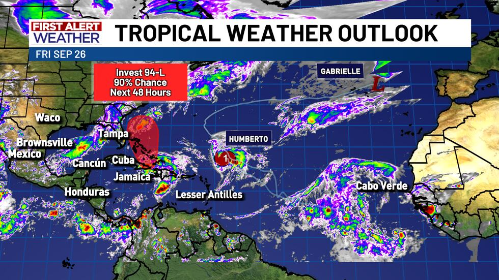
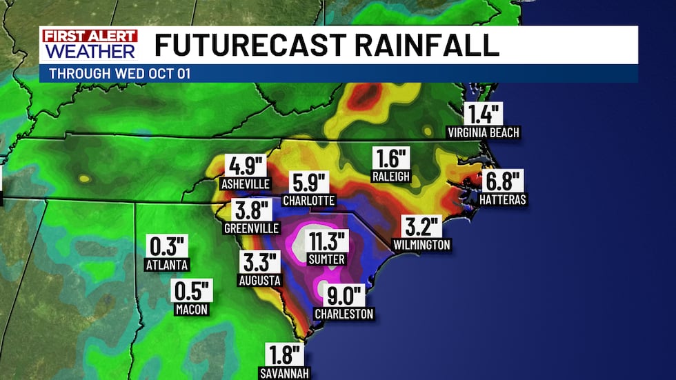
Model data shows that this system is likely to do one of two things as it continues northward: either move very slowly and be forced out eastward into the open ocean before making landfall in the U.S., or moving more quickly, continuing north-northwest, and impacting South Carolina. If this storm does impact the Carolinas it will not be a particularly strong tropical cyclone as it will not have much time to develop over open water beforehand, but it will carry a major flooding risk as model data shows this storm potentially dumping a foot or more of rain on parts of inland South Carolina.
Copyright 2025 KWTX. All rights reserved.


