A Change in Wind Direction is Bringing a Change in Temperatures... Barely.
Well we almost hit a record high yesterday, but today we have been a little cooler as our winds are now coming out of the northeast and they are bringing some slightly cooler and drier air down into Central Texas.
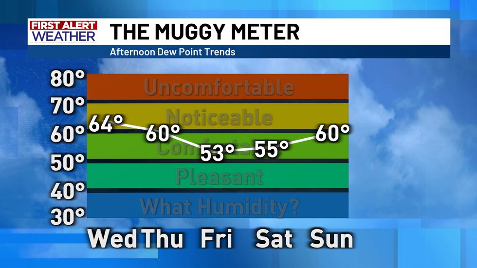
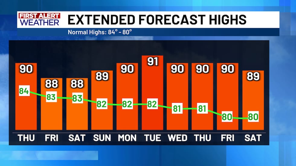
With that drier and cooler air moving in, our highs are going to be “falling” down to the upper 80s by Friday… so only a change of a few degrees. Morning temperatures are where we are going to see the largest change as Thursday and Friday night they will be down in the upper 50s to right around 60. These morning temperatures, while they are noticeably lower than we have been seeing, are actually right around average for this time of year, a testament to just how far above average we have been consistently over the last few weeks.
That above average trend isn’t going anywhere anytime soon however, highs are staying above average and lows will rise back up over the weekend and those consistent highs around 90 will continue for at least the next 10 days. Upper level high pressure is camped out over Texas and just doesn’t want to leave which is keeping us in this warm and sunny pattern.
Copyright 2025 KWTX. All rights reserved.


