Our Stretch of Cold Weather Starts Tomorrow
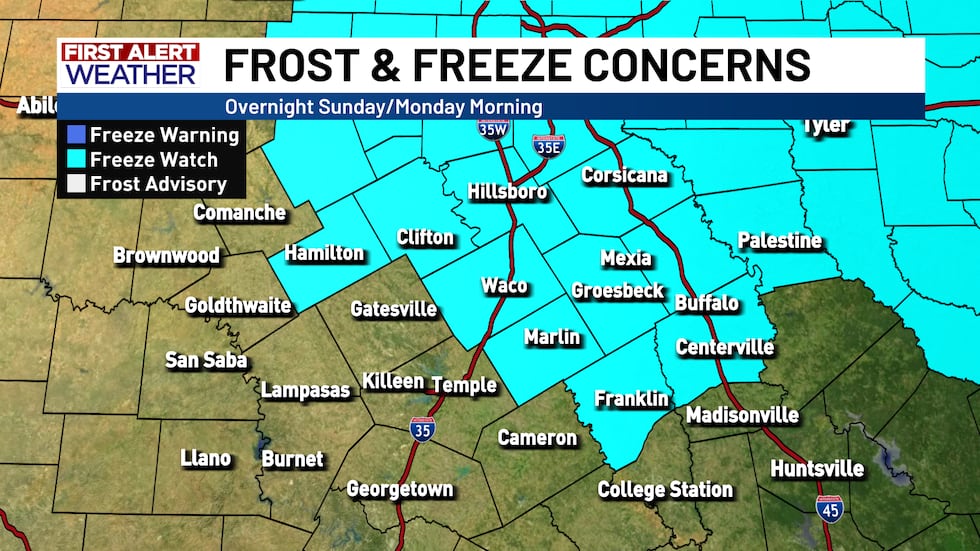
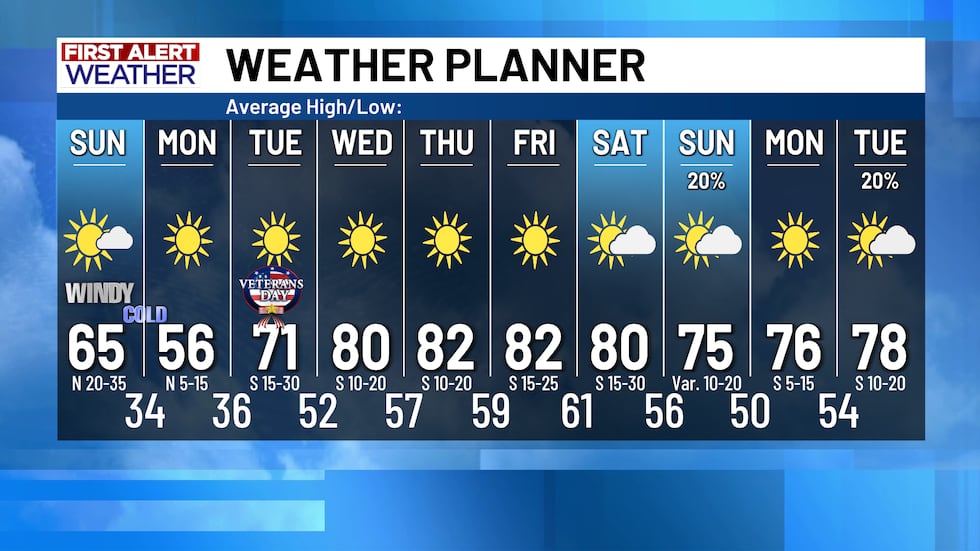
We are in for a two day stretch with cool afternoons and cold mornings starting tomorrow and continuing through Tuesday morning. Tomorrow’s high temperatures will be nearly 20 degrees colder than they were today and a Freeze Watch is in effect for Sunday night and Monday morning! With temps in the low 30s as you are headed out the door on Monday and not much warmer for your Tuesday commute, breaking out a winter jacket looks like a good idea.
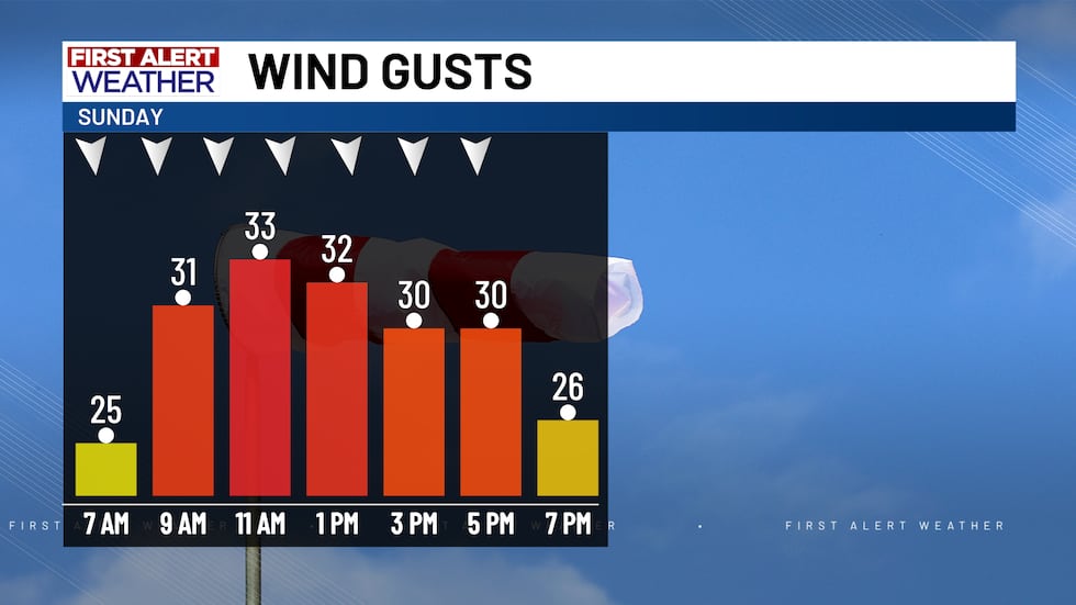
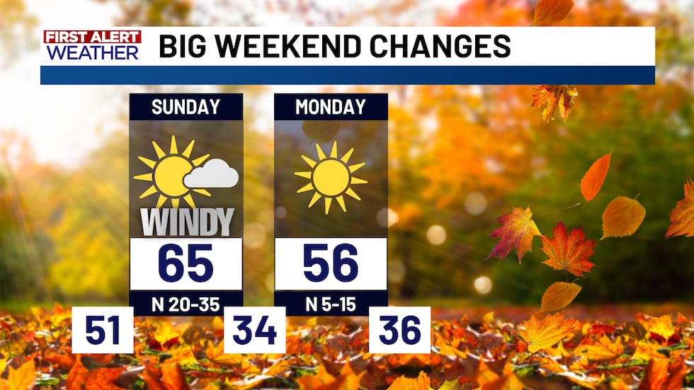
Tomorrow morning will be a pretty standard morning with temperatures down in the 50s, but winds will pick up speed rapidly, blowing out of the north at more than 20 MPH with gusts up to 35 MPH, and bring a lot of cold air down with them. Tomorrow afternoon’s highs will not get out of the 60s, and as colder air continues to move in, Monday will be even colder.
Monday morning temperatures will be near freezing if not below freezing in some areas. Winds will be much lighter than the day before but will still make it feel a good 5 degrees colder than the actual temperature, so make sure you are prepared for that cold as you are headed out. Afternoon temperatures on Monday will be in the 50s, sunshine and relatively light winds will help it feel nice but it will definitely be sweatshirt weather all day on Monday.
Tuesday morning will be another chilly one with morning temperatures in the 30s once again, but winds will flip around and blow out of the south bringing warm air back in throughout the day and leading to afternoon temperatures around 70. Warm air will continue to move in throughout the rest of the week, bringing our highs back into the 80s.
We are tracking a few rain chances moving into next weekend and the week after. Forecast models disagree on how likely we are to see rain as well as the timing of that possible rain, but what is clear is a surface low pressure is set to move across the country to our north and a trailing cold front could bring some rainfall to Texas.
Copyright 2025 KWTX. All rights reserved.


