Typical Summertime Weather Continues
Low Rain Chances Next Weekend, Confidence Is Not High For Now
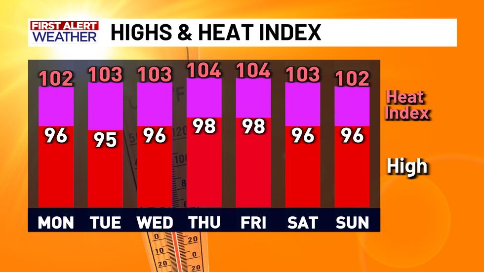
Lets go!! Typical summertime heat and humidity is back and here to stay for a while.... which is something that I never thought I would root for. There is no doubt that the last few weeks have been some of the rainiest that the month of July has ever seen, but Central Texas is now seeing the summertime high pressure ridge regain control in the forecast. This means temperatures in the mid to upper 90’s with high humidity is expected from now through the end of the week at least. Heat index values will be between 102° and 104° for the next few days (not quite 105°, so heat advisories are not expected, but it will still be hot).
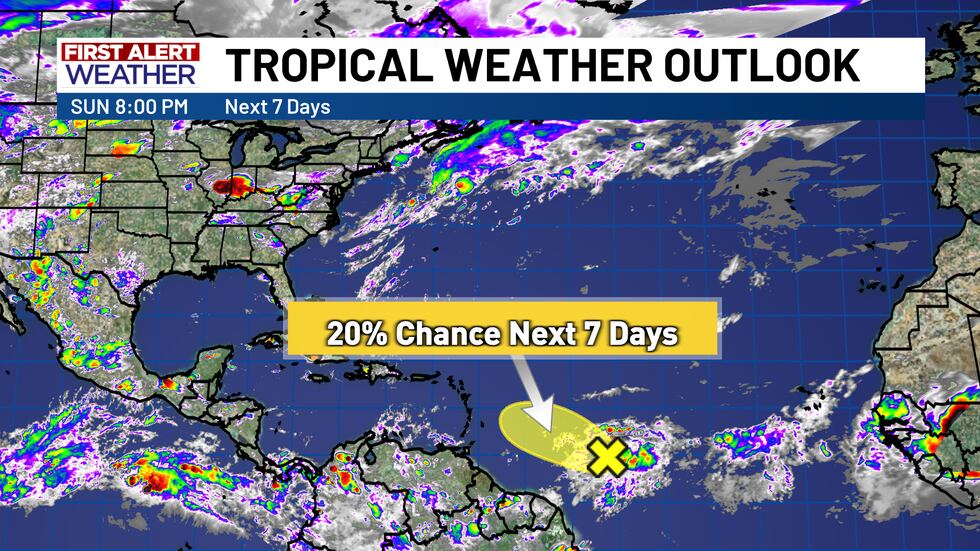
We are also keeping track of a tropical disturbance just to the north of South America that has been given a very low chance of development in the next week (20%). Depending on how this tropical low evolves, it could potentially bring some higher rain chances for Central Texas next weekend, but the odds are not very likely based on the latest model data. With that in mind, confidence is not that high either, given the long range/long term nature of this system. Therefore, we will keep a 20% chance for rain next Saturday, and revise it as more information becomes available. Highs next weekend will still be in the 90’s.
Copyright 2025 KWTX. All rights reserved.


