Dry Heat Builds Through Midweek, Rain Chances Could Return Next Weekend
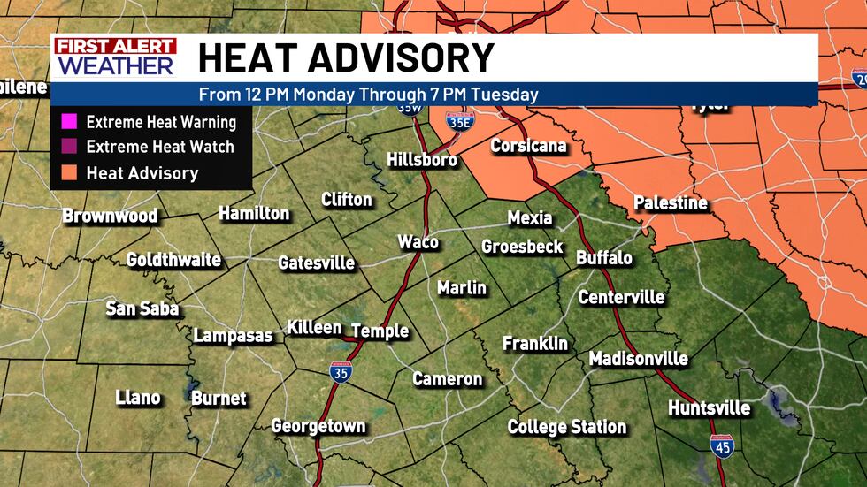
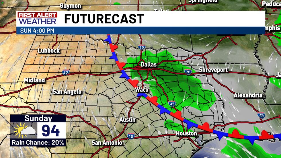
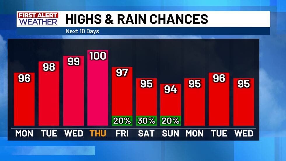
The scattered showers nearer to the I-45 corridor should dissipate before midnight tonight, leaving Central Texas nice and quiet through Monday! Temperatures Monday morning will start in the mid to upper 70’s, before climbing into the upper 90’s for the afternoon high. A Heat Advisory will be in effect for Navarro County (and ONLY Navarro County) from noon Monday to 7 PM Tuesday. The heat index around the Corsicana area could be up to 105° while most of Central Texas sits a few degrees lower, in the 97° to 104° range. It will still be hot no matter where you are at in the area on Monday, and through the rest of the week.
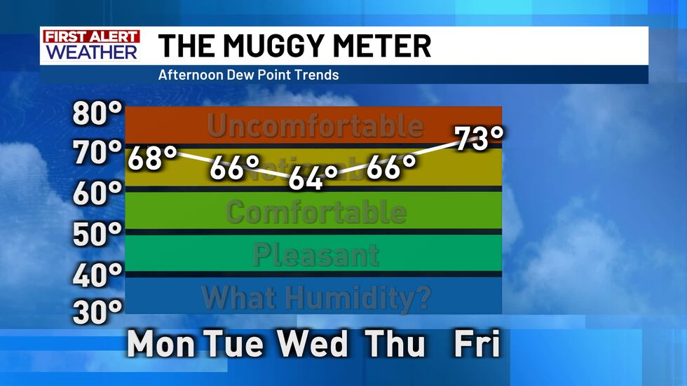
Speaking of the rest of the week - the heat by midweek (Wed/Thurs) will likely be a bit of a drier heat! Winds will calm down, allowing the flow of Gulf moisture to let up just a bit. This will bring down humidity (only a little bit) and bring the heat index into the upper 90’s and lower 100’s for most of the area. Despite this slight change, the actual air temperature is expected to increase, so this might not be a noticeable change for most Central Texans. Our area could get very close to (if not reach) the triple digits once again on Wednesday and Thursday.
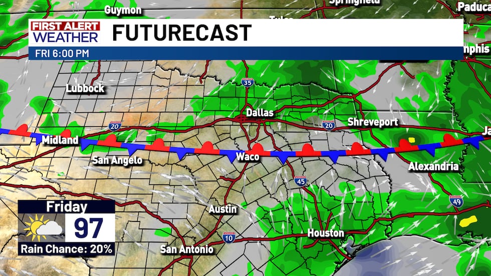
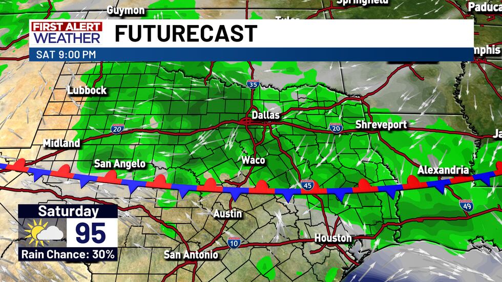
Next weekend, rain chances will make another return. A very weak front will likely make its way in sometime on Friday, and slow down/stall out underneath the influence of the upper-level high pressure ridge. This could keep some scattered showers around next Friday through Sunday, so we are keeping rain chances up to about 20% to 30% next weekend.
Copyright 2025 KWTX. All rights reserved.


