Rain Chances Return Tomorrow With Slightly Cooler Temps
Cooler Weather Possible Next Week!
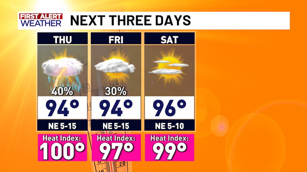
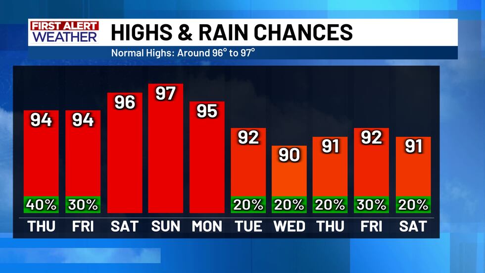
After the showers and thunderstorms cleared the area this afternoon, Central Texas is now entering a period of quiet weather until Thursday morning. Scattered rain chances will return on Thursday afternoon in a very similar fashion, but not quite as widespread. Rain chances Thursday decrease to 40% and eventually to 30% on Friday. Temperatures will remain in the mid 90’s.
Temperatures will rebound back into the upper 90’s by Sunday once Central Texas dries out a little more, but we could see the temperatures drop once again by the middle of next week - maybe even as low is the lower 90’s or upper 80’s by next Wednesday (August 27th)!
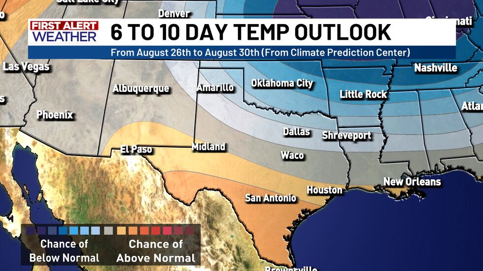
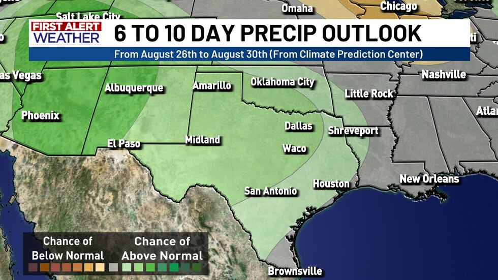
Models have not gotten a good handle on this yet, so timing and location is still TBD: but it appears another cold front could move in sometime next week, bringing more scattered rain chances, therefore dropping the temperatures a little. It will still be warm, but for August standards, cool!
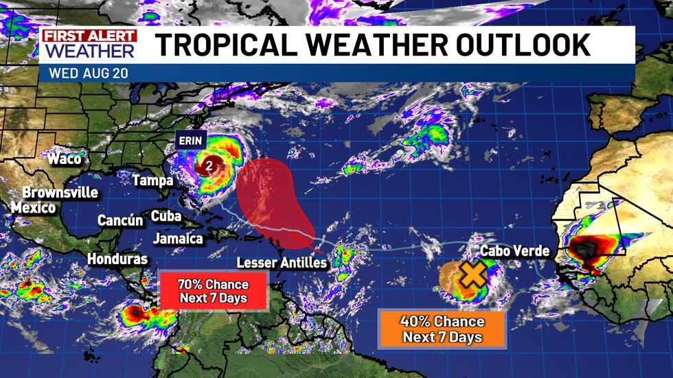
In the tropics, Hurricane Erin has made its northward turn and is expected to move between the U.S. east coast and Bermuda. Minimal impact is expected along the U.S. east coast, but some areas could see strong rip currents and tropical storm force winds. There are two waves behind Erin that have medium to high chances of development in the next week, but it is too early to determine their track and strength. As of now, there are no tropical concerns in the Gulf.
Copyright 2025 KWTX. All rights reserved.


