Changes This Week: A Few “Cold” Fronts Could Make Or Break The Forecast
Slightly Cooler Temps And Rain Chances Possible
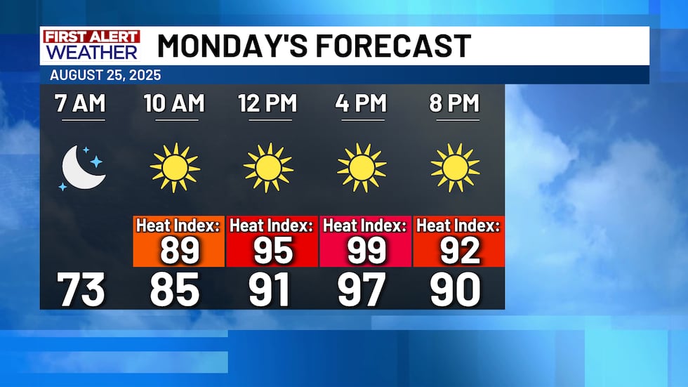
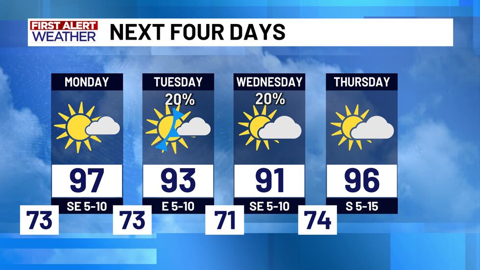
Much like most of Sunday, Monday will be another hot and dry day here in Central Texas! Temperatures in the upper 90’s with lots of sunshine will showcase the usual weather around here in the month of August. However, what is less common in a Central Texas August is temperatures in the 80’s with rain chances...and we might have some of that this week!
Tuesday - Wednesday: First “Cold” Front
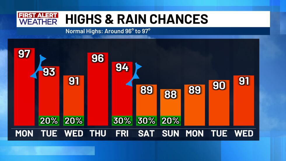
The first of the big changes will attempt to roll in on Tuesday. A cold front is forecast to come into North Texas, bringing scattered showers and cooler temperatures up there on Tuesday afternoon...but will the front make it south into Central Texas? That is the big question right now. IF (and remember, “if” is NOT a guarantee) this cold front manages to push into Central Texas before slowing down, we could see about a 20% to 30% chance for scattered showers. This is what most weather data has been indicating for the last few days. However, some model data is now suggesting that this front could stop short of Central Texas and stall over North Texas, increasing the rain chances to our north even further. This wouldn’t completely eliminate our rain chances, but it could certainly limit the coverage some. So, keep a close eye on the radar on Tuesday and Wednesday, as some scattered showers are possible - but not everyone may see it! Nothing severe is expected and regardless of the front, temperatures are expected to be in the low 90’s.
Thursday
Central Texas will likely get a break from rain chances on Thursday. Warming up and drying out on Thursday will bring temperatures back into the mid 90’s once more, with a wind out of the south between 5 and 15 miles per hour.
Labor Day Weekend: Second “Cold” Front
Unlike the front on Tuesday, Friday’s front has a decent chance at pushing all the way into Central Texas. This would bring a higher chance for scattered showers and maybe even some cooler temperatures next weekend! It will still be in the mid 90’s on Friday with a 30% chance for those scattered showers, but by Saturday and Sunday, temperatures could fall into the upper 80’s with similar rain chances. So, if you plan on attending the first Baylor football game of the year, or if you have any outdoor plans for Labor Day weekend, keep in mind that there are some scattered rain chances in the forecast. Much like Tuesday, we are not expecting severe weather, and not everyone will see the rain - hence why we call them “scattered” or “isolated” rain chances.
Labor Day And Beyond
There is a non-zero chance Central Texas could see more fronts and showers next week, but it is too far out to talk about any of that with any level of confidence right now. Good news is, temperatures will stay in the upper 80’s/lower 90’s for Labor Day Monday, and there are no rain chances forecast for Monday either, so enjoy it while it lasts!
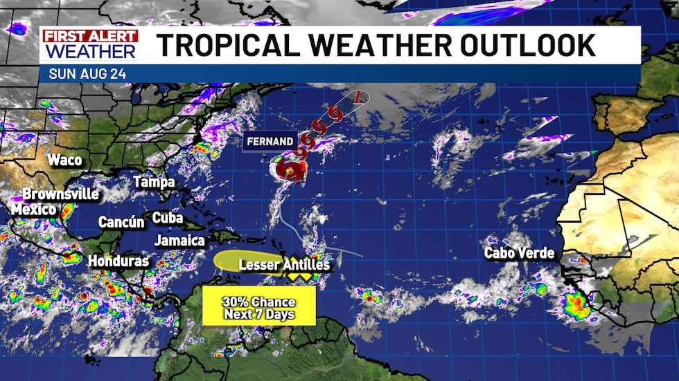
The tropics have calmed down quite a bit, as Erin has dissipated and Tropical Storm Fernand is nothing but a fish storm over the open Atlantic Ocean. There is one tropical wave near the Lesser Antilles that is worth watching, but it has low chances of development as of Sunday afternoon. Nothing to worry about for the Gulf at the moment - just keep an eye on the rain chances and cooler temperatures this week!
Copyright 2025 KWTX. All rights reserved.


