Changes Are Still On The Way - But Rain Chances Are Slim
We still have a few changes in the First Alert Forecast for Central Texas, one of which is in regard to the amount of daylight. Tonight is the last 8 PM sunset of 2025 in Central Texas! Between now and September 15th, Central Texas will go from 13 hours of daylight to 12 hours and 20 minutes of daylight. We will continue losing daylight until the Winter Solstice. In other news, the one thing that could have limited our rain chances on Tuesday and Wednesday appears to be occurring.
Tuesday and Wednesday
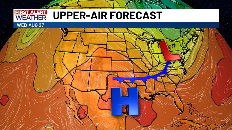
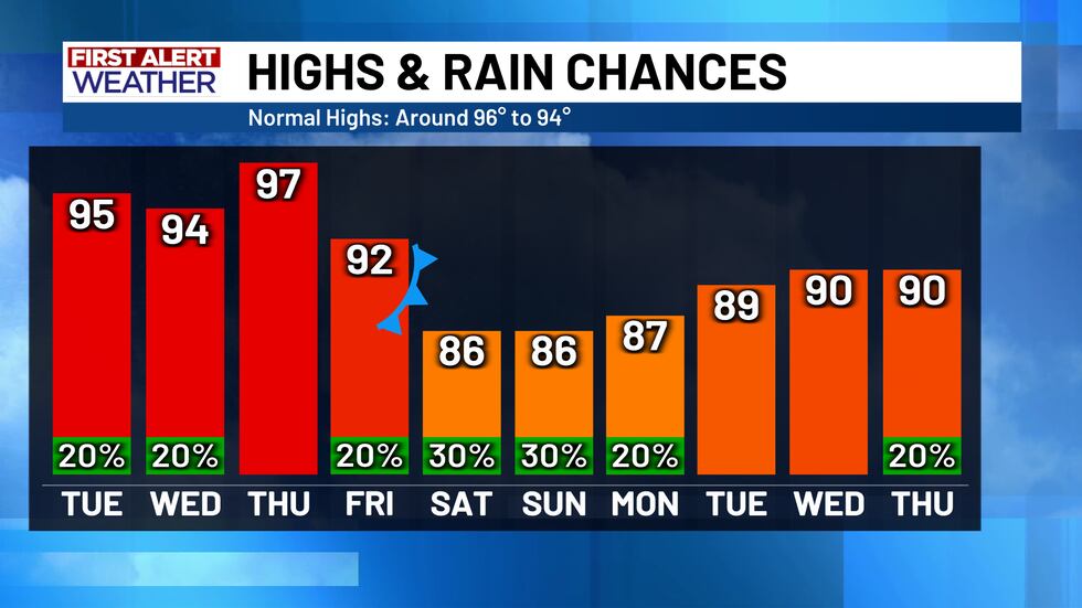
In the battle of high and low pressure, it appears that the high pressure heat dome will win out on Tuesday and Wednesday, blocking a potential “cold” front from entering Central Texas and trapping the rain and cooler air mass to the north in North Texas and Oklahoma. This won’t eliminate our rain chances in Central Texas completely, but it will certainly limit them, as we are still keeping a 20% chance for some isolated showers (especially across our southern counties). This also means the temperature drop on Tuesday and Wednesday will not be as large as originally forecast, staying with afternoon highs in the low to mid 90’s.
Thursday
The same “cold” front that is being blocked by the high pressure ridge, will eventually return as a warm front on Thursday, as it fails to push through the high pressure air mass. This means instead of having low 90 degree highs on Thursday afternoon, Central Texas will warm up even further, with highs likely in the upper 90’s and no rain chances.
Friday Through Labor Day
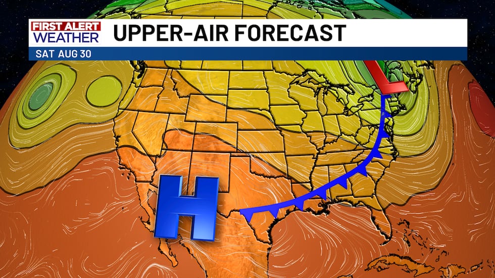
By late Thursday and early Friday, the high pressure ridge will start to slide to the west again. This will allow enough room for the very same frontal boundary to return once more, this time finally pushing all the way through Central Texas as a “cold” front. This is what the latest model data is still suggesting, and if it comes to fruition, Central Texas could see elevated rain chances (about 30% on Friday and through Labor Day weekend), as well as afternoon highs in the mid to upper 80’s!
Copyright 2025 KWTX. All rights reserved.


