Labor Day Weekend Cooldown Is Still In The Cards!
Weekend Rain Chances Are Rising Too
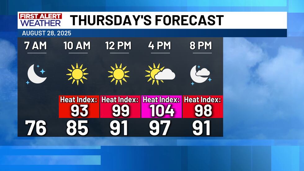
A few isolated showers are lingering in Central Texas this Wednesday afternoon, but most of the area will be left high and dry today. Going into Thursday, a the stalled “front” will return to the north as a warm front, drying out Central Texas and warming it up even further for Thursday afternoon (highs likely in the upper 90’s). So it will feel like summer again on Thursday, BUT, we will go right back to feeling like mid to late September going into the weekend! For a full breakdown of the forecast for all of the events going on this weekend, you can click this link here.
The same warm front from Thursday will slow down over north Texas, and eventually return to Central Texas as yet another cold front. This time, the odds are looking good that this time it will actually bring the cooler air and higher rain chances along with it. Rain chances up to 40% - 50% on Friday through Sunday will accompany afternoon highs in the mid to upper 80’s! This will be a great way to round out the month. We aren’t anticipating a washout, but some long range model data suggests a slight uptick in rainfall totals for Central Texas. Areas west of I-35 could see close to an inch or more, while areas near and east of I-35 could see between 0.25 to 1 inch. Keep in mind that these are just estimates, so don’t be surprised if there are some isolated heavier totals in some areas as well.
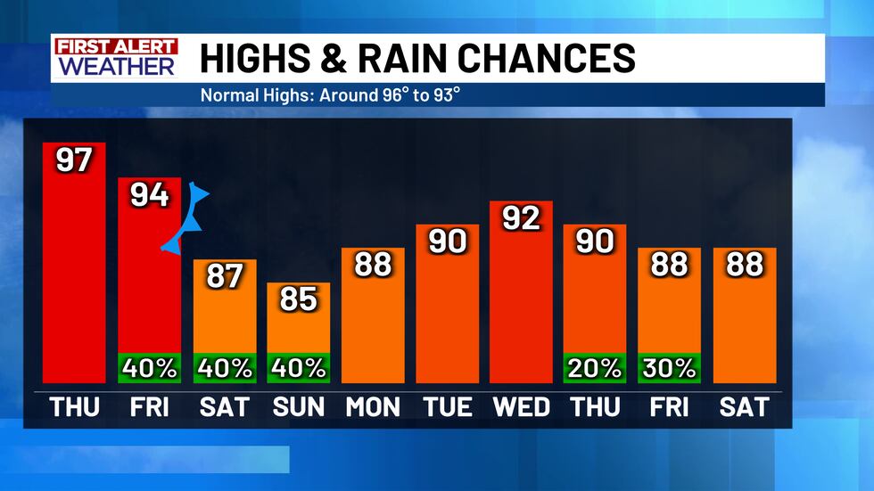
The 80° temperatures will continue on Labor Day, before slowly rising back into the low 90’s by the middle of next week. There are some early signs of more rain chances at the end of the 10 day forecast, but only time will tell how these rain opportunities evolve.
Copyright 2025 KWTX. All rights reserved.


