The First Day Of Fall Still Feels Like Summer
Don’t Worry - Changes Are Still On The Way!
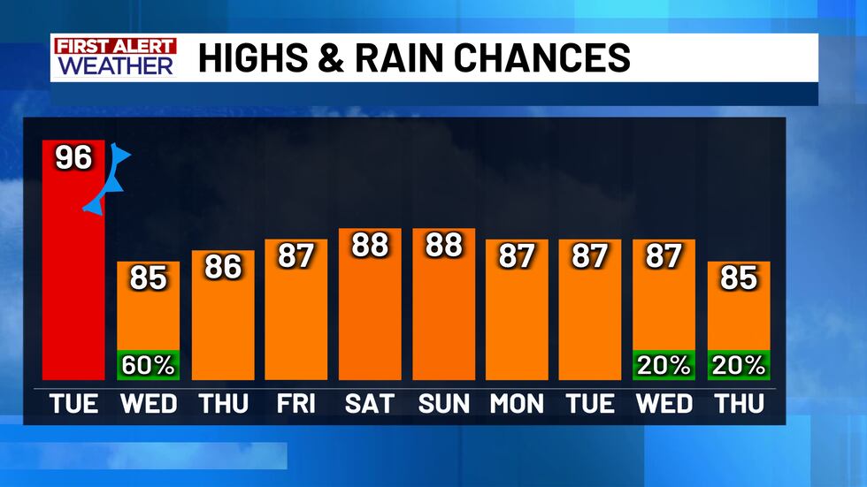
Happy first day of Fall! If you are sitting here and reading that first sentence, thinking to yourself “but C.D. it doesn’t feel like Fall,” you would be right! Despite today being the Autumn Equinox (Fall officially began at 1:19 PM Central Time), the summerlike weather is still hanging around. Monday afternoon is hot and humid, with highs in the 90’s once more. The same can be said for Tuesday’s forecast, as most of the day will be spent with hot and sunny conditions. Do not worry though - those fall conditions are just around the corner! A cold front is set to arrive late Tuesday and into early Wednesday. This front could have some lasting impacts on the forecast as well!
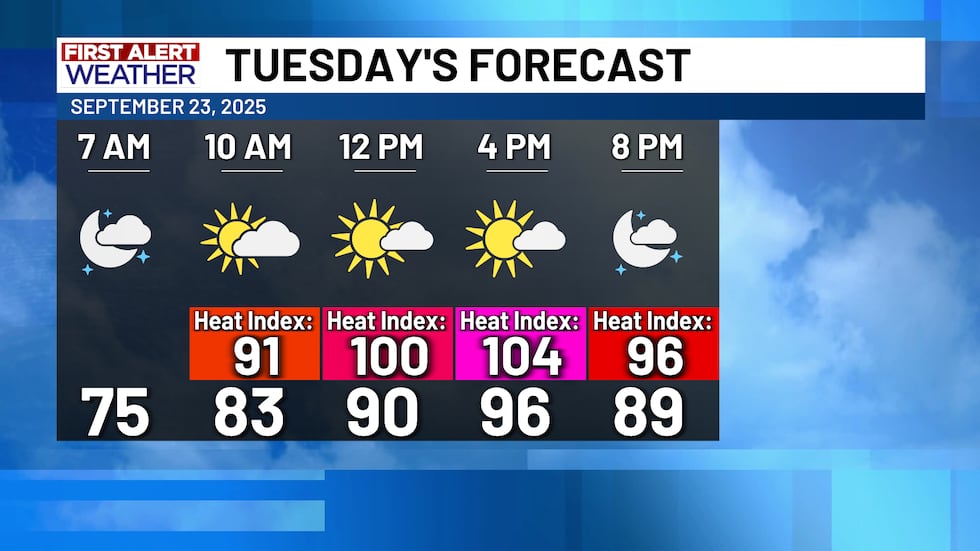
Above is another look at tomorrow’s forecast. Highs in the 90’s and partly cloudy skies will make it feel very similar to what Central Texas is experiencing today. However, the changes do start to roll in late Tuesday night.
Tuesday Evening/Wednesday Morning
The Storm Prediction Center (SPC) has forecasted a level 1 out of 5 Marginal Risk for severe weather on Tuesday evening and going into early Wednesday morning in Central Texas. This is associated with the cold front that will be moving into the area, bringing cooler temperatures and a 60% chance for showers during the Tuesday evening/Wednesday morning timeframe. The good news is, the line of thunderstorms should be weakening by the time they reach Central Texas, as the higher risk for severe weather (a level 2 Slight Risk) is in place for parts of north Texas, Oklahoma, and Arkansas. So - while the storms are going to weaken as they drop south into our area, a few of them could remain on the strong side. The storms will also likely impact your Wednesday morning commute, so make sure to leave the house with an umbrella or rain jacket in tow!
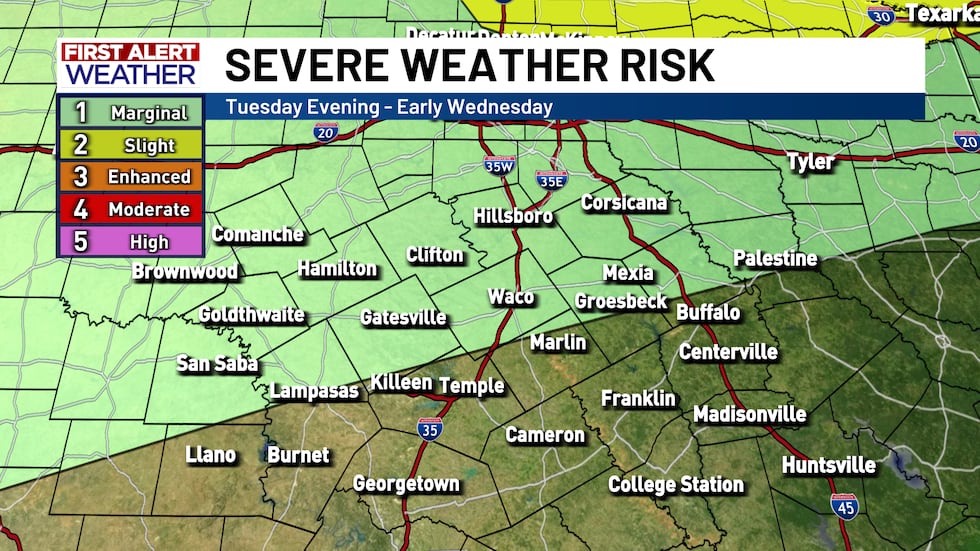
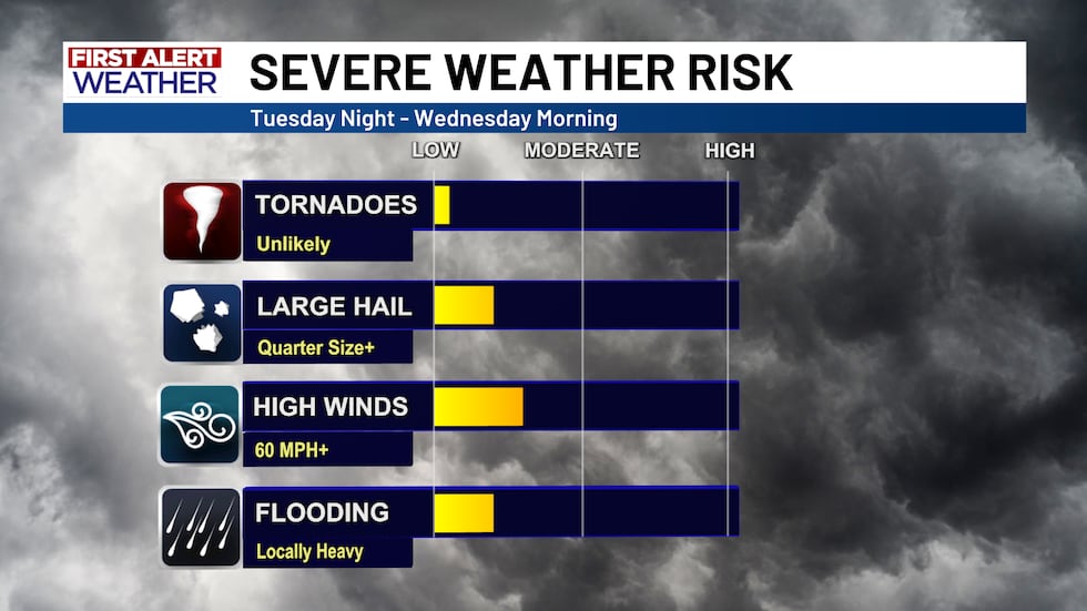
Essentially what this level 1 Marginal Risk amounts to, is an elevated chance for some gusty winds and hail up to quarter size. We do not anticipate any widespread severe weather going into Wednesday morning, but as mentioned previously, some of the stronger storms could be capable of producing such hazards. The flooding risk is low (but not zero) as locally heavy rainfall could lead to isolated flooding. Tornadic activity is not anticipated.
After Wednesday morning, the showers should begin to clear out on Wednesday afternoon, leaving Central Texas with high temperatures back in the mid to upper 80’s. The impact of this cool front will actually last this time around as well! Afternoon highs *should* stay in the mid to upper 80’s through much of next week, which is also in line with the average highs for this time of year. So believe it or not, the forecast for the next week and a half is pretty normal!
Copyright 2025 KWTX. All rights reserved.


