Welcome To Warmtober - Actually, I Mean October!
Spooky Season Begins With A Not So Spooky Forecast
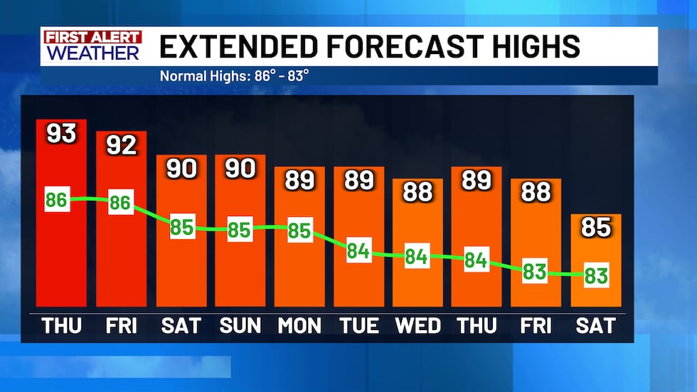
The title pretty much sums it up - today is the first day of October and the warmth is expected to continue! Over the next 10 days, the climate data shows the average high temperatures dropping from 86° to 83° and the low temperatures dropping from 61° to 58°. However, our forecast is still nowhere near those numbers. Above normal temperatures will continue with lows in the mid 60’s and highs in the 90’s returning for Thursday afternoon. Lots of sunshine will come along with the warmth! Keep this in mind too: October is the second wettest month on average and there is NO RAIN in the forecast. If the forecast doesn’t change any time soon, it is very possible that Central Texas could be bone dry for at least the first half of the month.
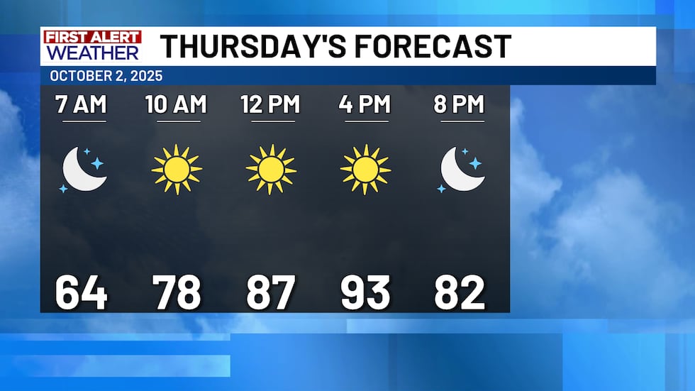
Another close look at Thursday’s First Alert Forecast shows the conditions that were mentioned previously - highs in the 90’s with lots of sunshine!
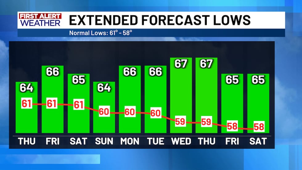
Both the morning lows and afternoon highs are expected to remain above average for the next week and a half. In these charts, you can see the expected average temperatures (red line on the lows, green line on the highs) compared to the forecasted temperatures (the bars), indicating the forecasted temperatures will be at least 5 to 10 degrees above average.
Copyright 2025 KWTX. All rights reserved.


