Santa Will Be Sweating When He Comes To Central Texas
Near Record Warmth This Christmas Week!

White Christmas? Nah...warm Christmas!! The weather will stay unseasonably warm in Central Texas for the next four to five days, with highs in the upper 70’s and lower 80’s. The morning low temperatures are going to hover right around where our highs should be during this time of year...in the upper 50’s and lower 60’s. There is a slight chance for a bit of cloudy drizzle on Tuesday morning, but otherwise, the weather should remain warm and dry until the weekend.
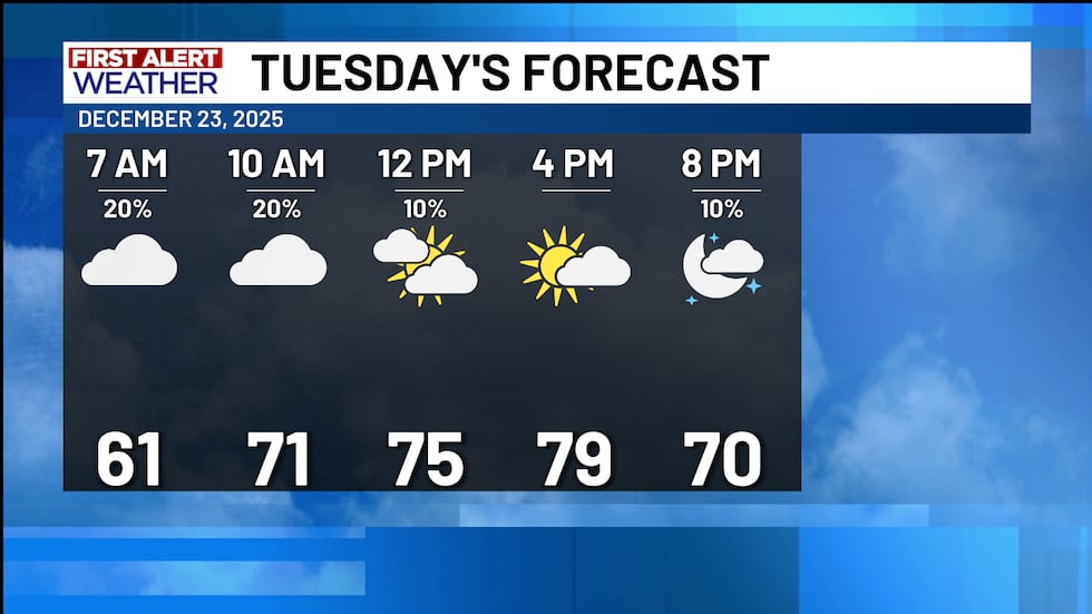
A 20% chance for some light drizzle on Tuesday morning will accompany the cloudy conditions before clearing on Tuesday afternoon. Tuesday will still be warm with highs near 80° in some cases.
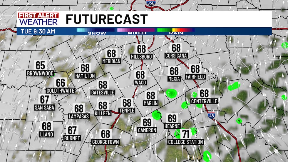
Our in house First Alert Futurecast is picking up on the light drizzle espeically east of I-35 on Tuesday morning. Not widespread by any means, but a possibility we will be watching!
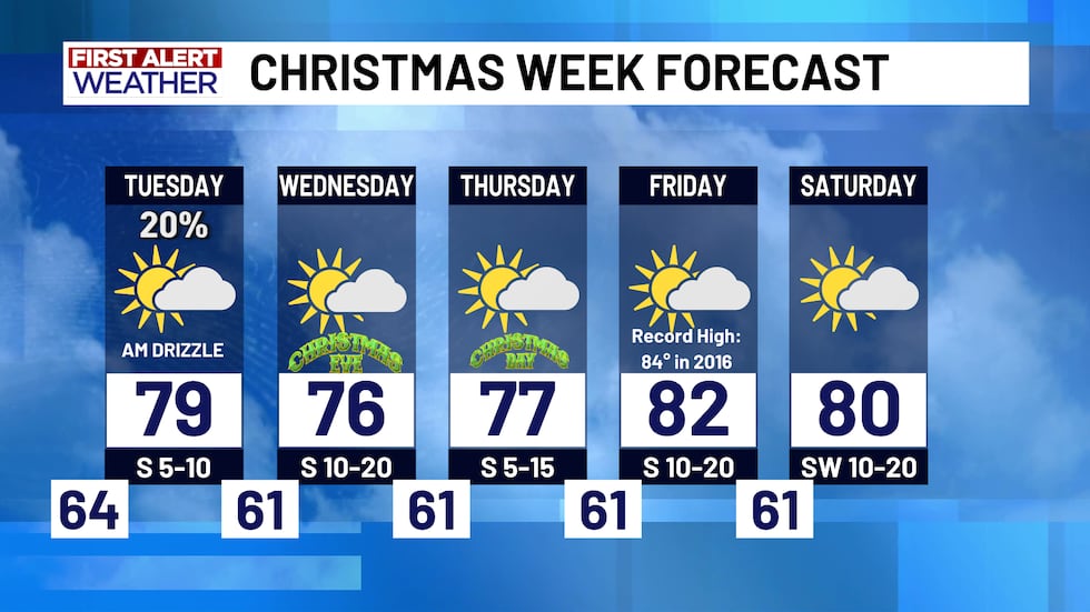
The record for the high temperature on Christmas in Central Texas is 82° that was set in 2021...we are NOT anticipating breaking that this year, but Central Texas could get close. Another record on Friday could potentially be broken with highs in the low 80’s.
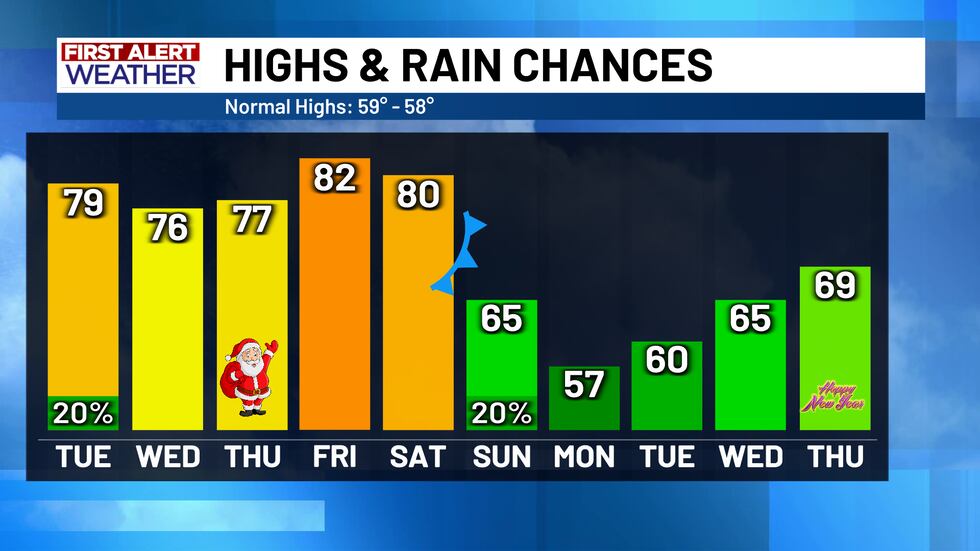
Long range data is picking up on a potential cold front some time next Sunday. This would relieve Central Texas of the much warmer than normal temperatures and put us back at a normal pace...and maybe even bring some light rain chances before the year is out!
Copyright 2025 KWTX. All rights reserved.


