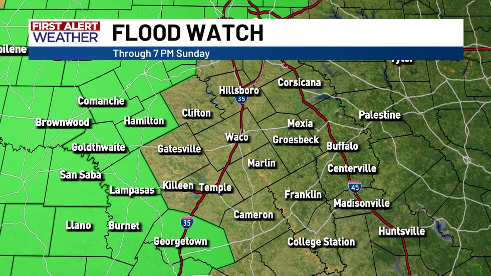
Flood Watch for western third of Central Texas this weekend
As we head into the weekend, we are keep an eye out for the return of scattered shower and thunderstorm chances. The flooding threat doesn’t look overly high for most of Central Texas, but some of our western counties could deal with some spotty flooding depending on where showers line up this weekend.
A FLOOD WATCH has been issued for areas across the Big Country and Permian Basin and into parts of Central Texas. Hamilton, Mills, Lampasas, San Saba, Burnet, and Williamson counties are under the watch through Sunday evening.
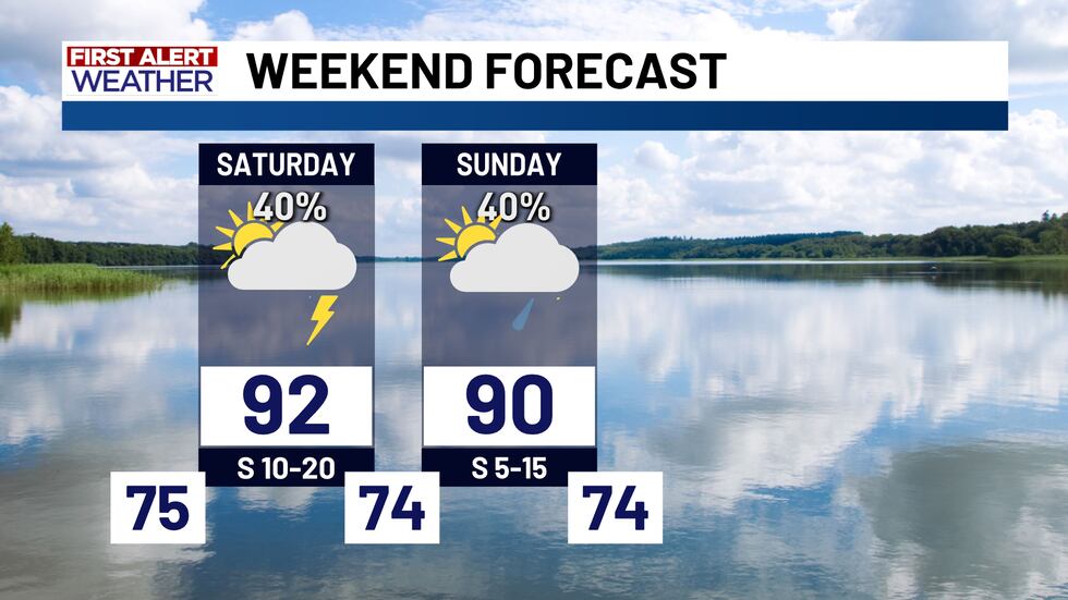
Scattered showers and thunderstorms will likely develop during the afternoon hours Saturday, and we could see some of this scattered activity stick around through the overnight timeframe. The best potential for flood producing rain will likely be to our west, but we will have to keep an eye on the development of these scattered showers and thunderstorms. If any of these storms move over areas that are already saturated from recent rain, that would lead to elevated flooding concerns.
Another round of spotty showers and thunderstorms is possible on Sunday. The severe weather threat looks pretty low throughout the weekend, but these storms could produce locally heavy rain (isolated flooding concerns), some lightning, and gusty winds.
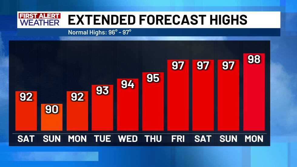
A few isolated showers may stick around for Monday, but most of next week looks hot and rain-free.
Copyright 2025 KWTX. All rights reserved.


