Isolated rain chance (south & east) today before rain-free and hot end to July
We could hit 100° before the month ends
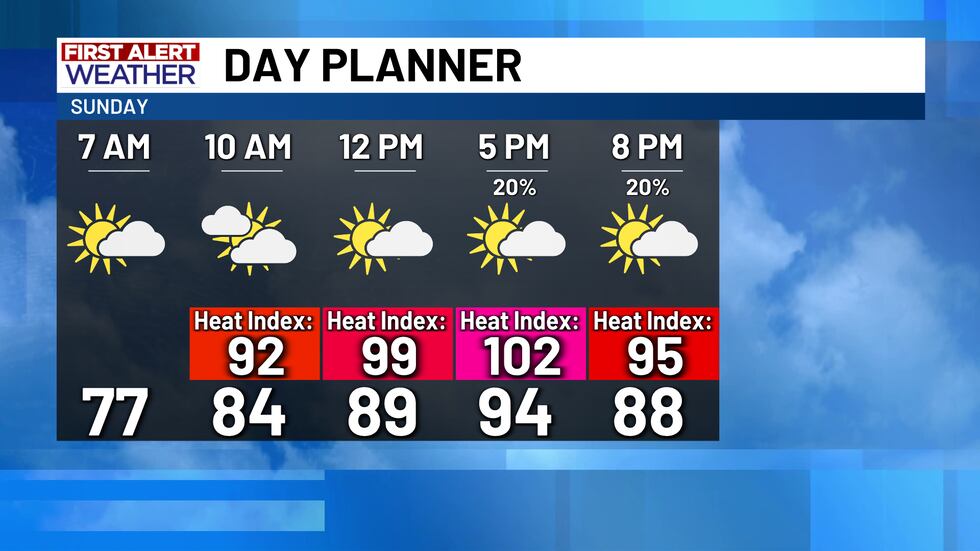
Sunday’s shaping up to be a copy-and-paste of Saturday. Morning temperatures will start in the mid-70s with a mix of clouds and sunshine, but by the afternoon—watch out for some pop-up “splash-and-dash” showers and storms, mainly east of I-35. Nothing severe, but you might catch a quick downpour or two if you’re in the zone. Highs will land in the low to mid-90s again, with heat index values flirting with 102-103° in spots.
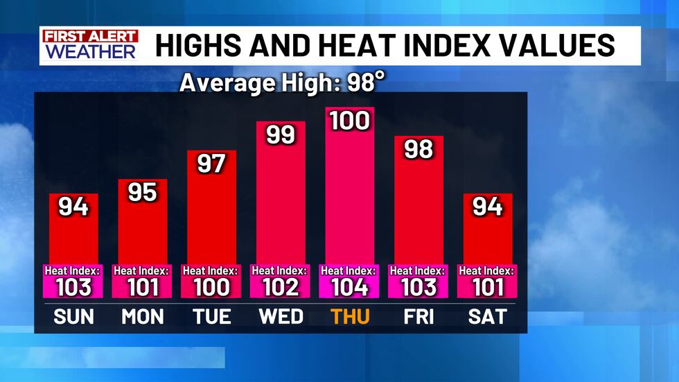
After sunset, the rain chances dip and then poof!—they’re out of the picture for most of the upcoming week. Why? That infamous summertime ridge of high pressure is making a comeback. It won’t stick around forever, but it’s bringing the heat—literally. Mid-to-upper 90s to start the week, and by Wednesday or Thursday, we may hit our first triple-digit temp of 2025! Right now, we’re eyeing 99° on Wednesday and 100° Thursday, but don’t be shocked if we hit 100° a day early.
The good news? That heat dome isn’t parking it for long. Another weak disturbance may swing through the Gulf by next weekend. While it’s not expected to become a tropical storm, it could bring back a splash of rain just in time for next Saturday and Sunday, with highs cooling slightly to the mid-90s. Plus, a cold front could flirt with North Texas—if it gets close enough, we might squeeze out a little more rain late next week.
So, soak up the sunshine but brace yourself: the heat is cranking up this week!
Copyright 2025 KWTX. All rights reserved.


