Nobody move. Nobody breathe. You’ll scare the rain chance away.
Just like with a t-rex and Sean Bellafiore, rain chances are based on movement. Instead of being eaten or being completely unseen (I promise, I’m not hungry), any sort of movement might scare rain chances away! There are a few rain opportunities, but you’re gonna have to wish extra hard to get one of those much needed showers to move through your neighborhood. Overall, rain chances over the next 10 days are near 30% if you add up all of the rain chances...
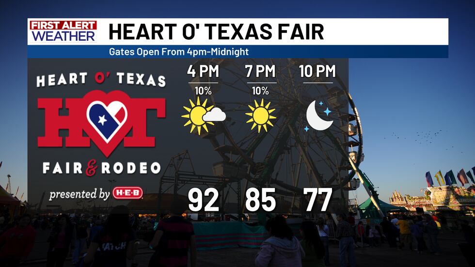
Today is the first of three upcoming days with a slight rain opportunity and I do mean slight. We’ve seen a slight bump in humidity this morning compared to yesterday and that will help to give us the opportunity for a shower, but the “high” shower chances will mostly stay near and especially east of I-35. Temperatures out the door are also a bit warmer today compared to yesterday. Instead of lower 60s, expect mostly mid-60s out the door turning to upper 80s for some and lower 90s for most. Expect rain possibilities from roughly 2 PM to 7 PM. It won’t be a bad Friday night for football games or heading to the Heart O’ Texas Fair. Temperatures in the 80s by sunset will only gradually drop. In fact, we’re still going to be in the mid-70s by midnight tonight!
A big change in the weekend weather is on the way! Our rain chances will drop by 100% from Friday into Saturday and Sunday! That’s my way of being funny...sorry if I gave you hope for anything different. Even though there really isn’t much of a big change, it won’t be an awful weekend! This weekend just isn’t going to be a seasonable weekend. Our average high is in the mid-80s and our morning lows should be in the lower 60s, but we’re having none of that. A small humidity drop this weekend may make it feel pleasant outside, but we’re starting the day in the low-to-mostly mid-60s Saturday and Sunday ahead of late-day highs in the upper 80s and lower 90s.
There actually is a notable change to next week’s weather: more humidity! Ahead of a cold front pushing through the country mid-week, we’ll see the return of a bit of humidity. That will boost our morning temperatures into the mid-to-upper 60s for the first half of the work week. Technically, the front will move through the area, but it honestly isn’t. A stray few showers are possible Tuesday ahead of the front east of I-35 and on Wednesday anywhere as the front “moves in”. The lower 90s hang around ahead of the front, but temperatures will then slowly drop back into the mid-60s by the end of next week for the morning hours with highs dropping eventually into the mid-80s by the weekend.
Copyright 2025 KWTX. All rights reserved.