A big cold front brings Central Texas big winds today and tomorrow!

Today’s one of those Central Texas days where the weather you go out the door to is not the same weather you’ll come back home with! A strong cold front is set to barrel through the area midday today which will usher in our coldest fall air of the season so far. Not only will temperatures tumble below average (for the first time in the afternoon all month long...), but we’ll also see a BIG increase in northerly winds behind the front today.
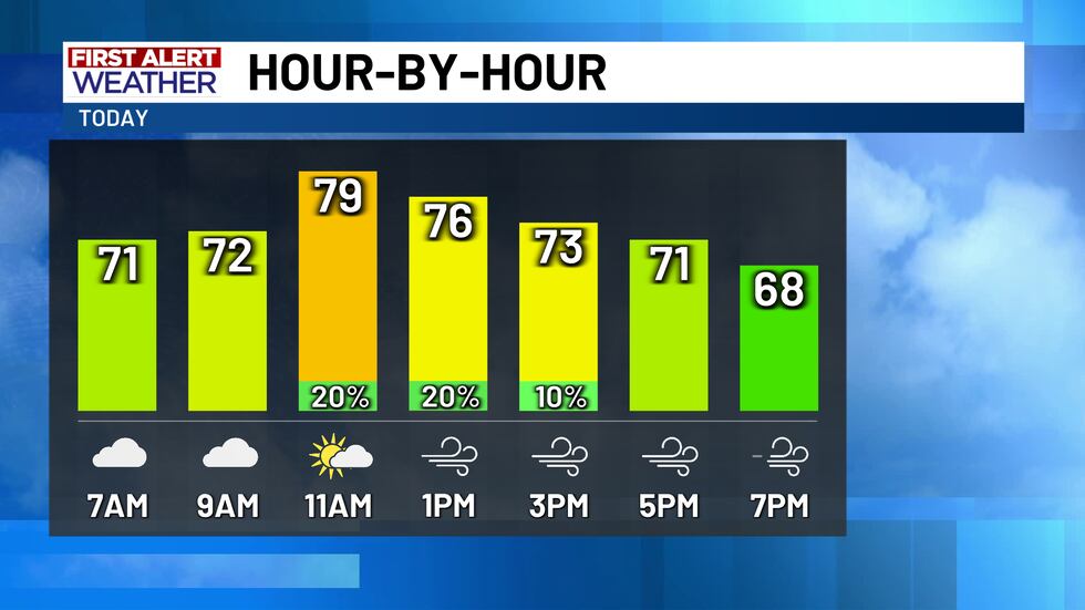
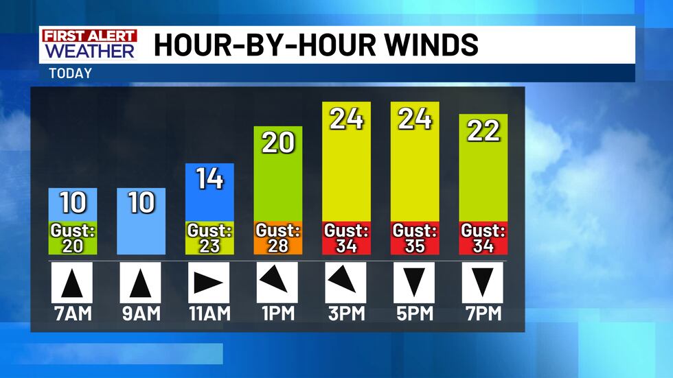
Today’s weather might catch you off guard if you’re not prepared for the changes. In the grand scheme of things, the daytime weather changes won’t be too difficult to manage, but we are expecting temperatures to fall this afternoon as the front pushes in. Morning temperatures in the mid-to-upper 60s will warm into the upper 70s and lower 80s by around midday today. Today’s cold front will push through late morning through the early afternoon hours and you’ll notice the front’s passage when the winds shift from the south to the north. North winds this afternoon will be strong! Sustained winds between 15 MPH and 25 MPH will occasional gusts between 30 and 40 MPH! Today’s front likely won’t drop much of any rain; there’s a 20% chance for a few afternoon showers near and east of I-35.
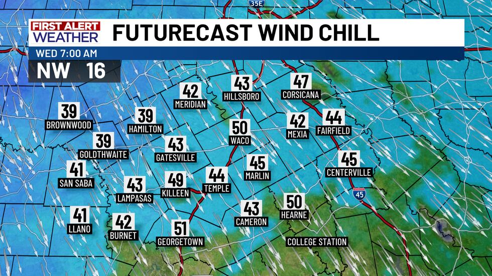
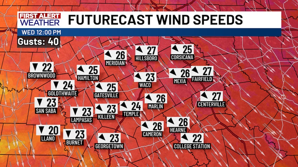
A surge of colder air tonight makes for an onion day of weather tomorrow where you’re going to want to layer up a bit! Temperatures tomorrow morning will tumble into the upper 40s and lower 50s which is fairly normal for this time of the year. The winds, though, will be whippin’! With north winds gusting to near 30 MPH overnight into the daybreak hours Wednesday, that’ll give us an out-the-door wind chill in the upper 30s for some and low-to-mid 40s for most! The north winds won’t relent Wednesday and will get even stronger. Wednesday’s sustained winds between 20 and 30 MPH will likely gust to between 35 and 45 MPH from time to time! With the door to the north wide open, the abundant sunshine Wednesday only manages to warm our high temperatures into the mid-60s which is around 10° cooler than average.
The winds will start to come down Wednesday night and there won’t be much wind to talk about for a while, but the calming winds and clear skies allows for Thursday’s morning temperatures to tank. We’re out the door Thursday (and Friday morning too) in the upper 30s for some and lower 40s for most. Temperatures Thursday afternoon will warm into the mid-to-upper 60s and will then warm into the upper 60s and lower 70s Friday afternoon. Trick-or-treating won’t be bad Friday night, but the kids might want a jacket! Temperatures in the low-to-mid 60s around sunset will fall steadily into the lower 50s by midnight.
There’s another storm system set to move through the state Saturday into Sunday. This storm system will just get going as it pushes through the area, so there won’t be much of a temperature change or a rain chance. We’ll call it a 30% chance for a few scattered showers Saturday with those chances dropping to 10% Sunday. The extra clouds Saturday will keep morning temperatures warmer in the mid-40s, but afternoon highs stay stuck in the upper 60s and lower 70s with more clouds than sunshine. We’re back into the mid-70s Sunday, but highs climb back above average both in the morning and afternoon with temperatures out the door in the low-to-mid 50s with highs in the upper 70s and lower 80s.
Copyright 2025 KWTX. All rights reserved.


