Wake me up when September ends
Fall? More like crawl. As in we’re crawling as slow as possible into the cold weather season. Despite the record low temperature Monday morning of 29° and the first freeze of the season for most Central Texans, we’re staring down near-average high temperatures next week for morning low temperatures joined by at least one record high temperature falling! It’s shorts and t-shirts weather for about the next week, but we’ll trade those in for an umbrella next week.
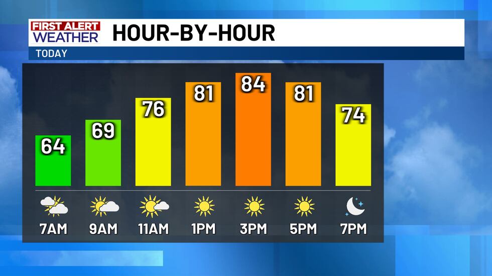
Temperatures this morning will largely start out in the lower 60s, but there will be some mid-60s out the door too! The extra warmth this morning is thanks to a big jump in humidity (again) overnight which should lead to morning fog around sunrise. Fog may not be widespread, but it should be locally dense so make sure to drive to conditions. Once we shake the morning fog, temperatures will warm into the low-to-mid 80s this afternoon, bolstered by an increase in south winds. South winds today will gust to near 25 MPH, but those gusty winds will tail off tonight for Friday night football games.
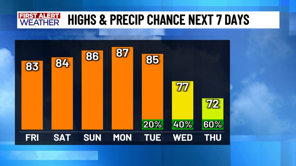
No major weather changes are expected through the beginning of next week, so we’re stuck in the heat and humidity! Is it going to be awful outside? Not at all. Is it going to feel anywhere close to what it’s supposed to feel like this time of year? Also not at all. Morning temperatures Saturday in the lower 60s will warm into the mid-80s both Saturday and Sunday afternoon with morning clouds giving way to afternoon sunshine. The same sky conditions return early next week, but we’re expecting temperatures to be in record territory! Monday’s record high of 89° is likely safe with a forecast high of 87°, but Tuesday’s record high of 84° should be eclipsed with a forecast of 85°.
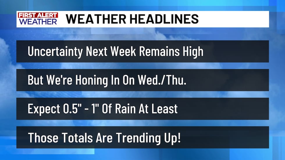
Rain chances and storm opportunities are on the way late next week, but we’re still left scratching our heads a bit. It’ll still be a few more days before we’ll have enough data to make a definitive call for how much rain will fall, when the rain will fall, and how many rounds of rain we’ll see. As of now, it’s looking like the next storm system blows through Wednesday into Thursday, but there’s a chance the storm system slows down and doesn’t push through until Thursday into Friday. It’s more likely that we’ll see the storm system mid-week, so rain chances are up to 40% Wednesday and 60% Thursday. We’ll likely see at least a half-inch to an inch of rain, but there’s a strong signal for multi-inch rainfall totals somewhere across Central Texas. We’ll need to fine-tune the details over the coming days and we’ll also have to monitor for a potential severe weather threat, so stay tuned to the forecast through the weekend so you can properly prepare for Food For Families week!
Copyright 2025 KWTX. All rights reserved.


