Are you ready for high temperatures in the 40s?!
A strong cold front is set to barrel through much of the country this weekend and may cause some significant travel delays in some regions of the country. For Central Texas, we’re monitoring for potentially a stray strong storm or two from the front but we’re also focusing on a HUGE drop in temperatures from Saturday to Sunday.
Saturday’s front is a almost a “blue-norther”!
You may not have heard the term “blue-norther” before, but it’s a Texas thing! A “blue-norther” cold front typically brings a quick and substantial drop in temperatures, strong winds, and usually cloudiness. We may not see the substantial temperature drop, but highs will drop almost THIRTY DEGREES from Saturday afternoon to Sunday afternoon!
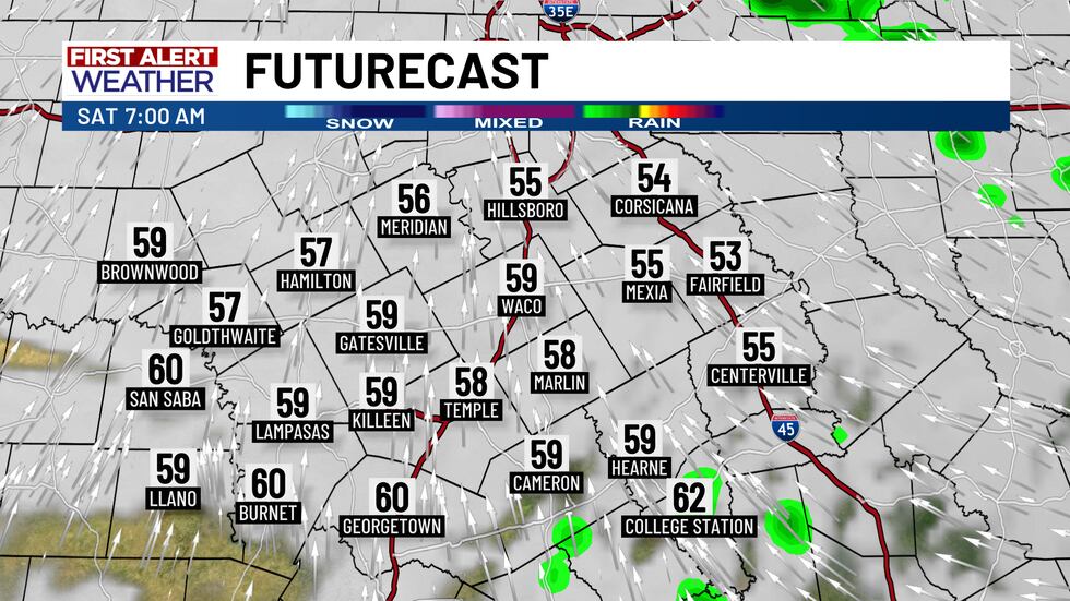
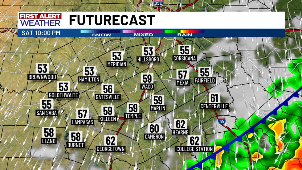
As a warm front passes through Central Texas Saturday pre-dawn, morning temperatures will warm up from the mid-50s into the upper 50s and lower 60s by daybreak. Some returning midday and afternoon sunshine ahead of the front will warm highs into the low-to-mid 70s, but then the bottom falls out!
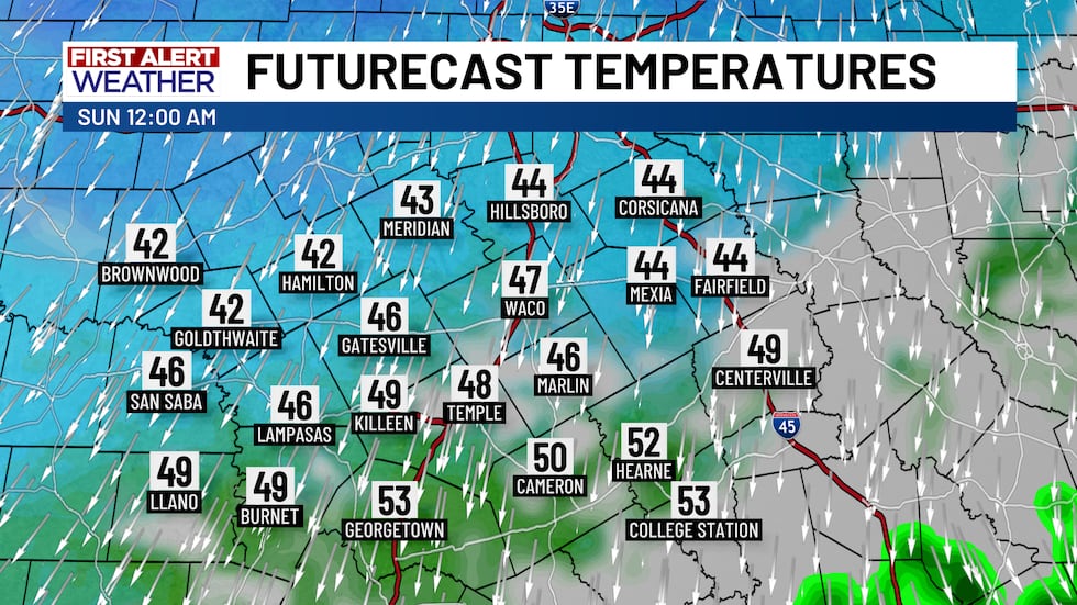
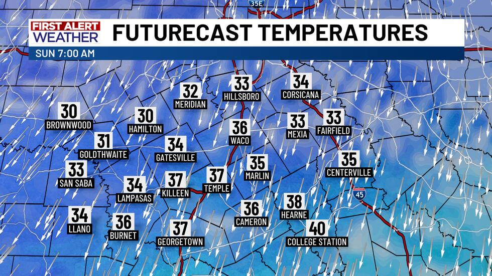
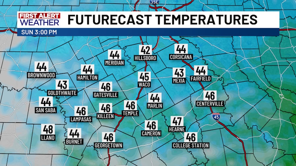
As the cold front surges through, temperatures will drop steadily Saturday night into Sunday morning and will settle in the 30s! Thanks to clouds overhead for most of the day Sunday, high temperatures will only reach the mid-40s.
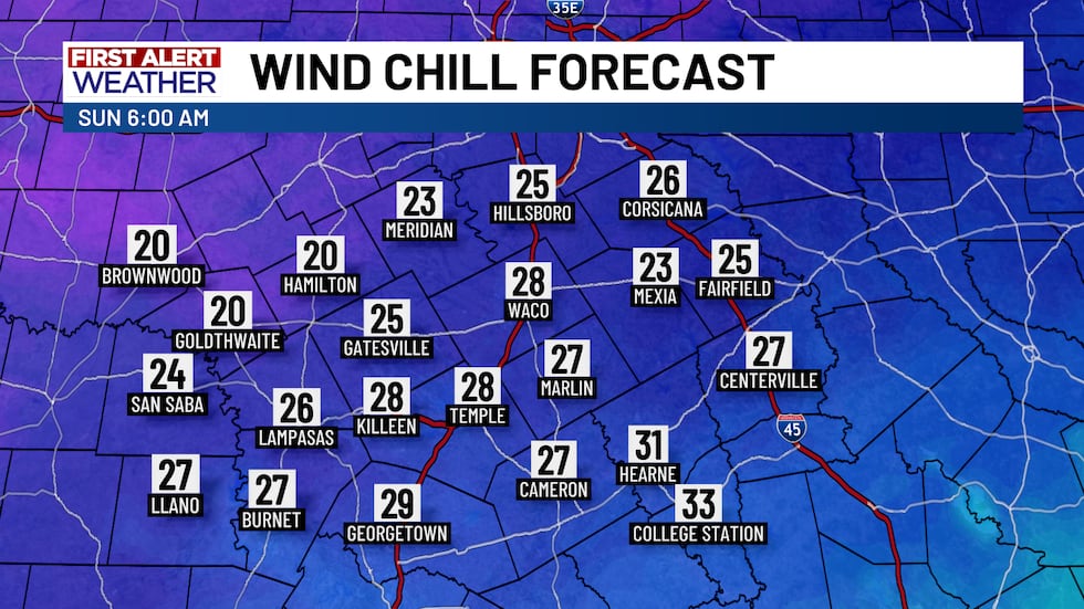
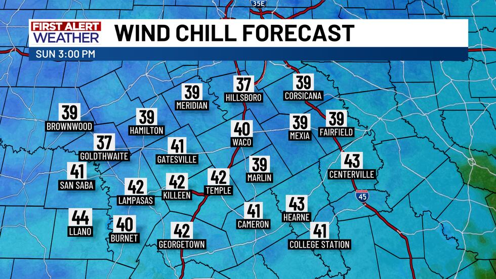
But wait, there’s more! The strong north winds with Saturday night’s front hang around Sunday. Wind chills Sunday morning in the 20s will only climb as high as maybe 42° Sunday afternoon for some of us.
Hail is the main severe weather concern
Although Saturday’s cold front brings a significant chill, rain and storm chances have been dropping a bit. All of the ingredients for strong storms will be present Saturday, but the elements may not line up at the correct time for severe weather. Still, we’re monitoring for the potential of hail!
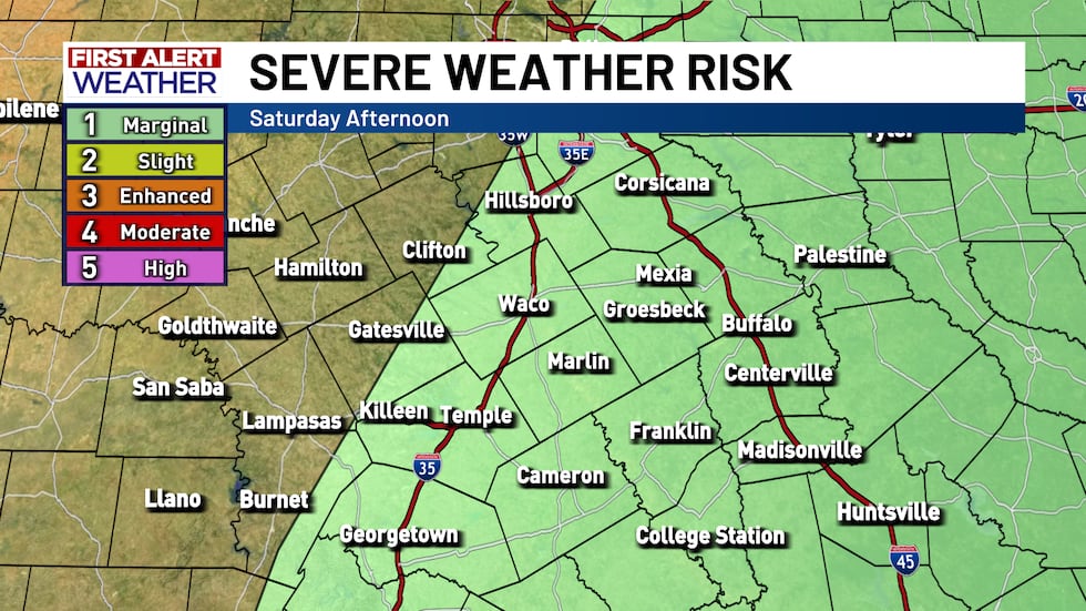
It’s quite easy for hail to form in Texas during the cold weather season because, well, it’s cold! If you hear thunder Friday night or Saturday, that thunderstorm could easily produce small hail up to about dime size. For the storms on Saturday, there could actually be a decent bit of small hail in the storms, but it’ll only be the strongest storms that may contain upwards of half-dollar size hail. Gusty winds are possible with storms too, but hail is the primary severe weather hazard.
Two rounds of rain are possible
The main severe weather concern is with Saturday’s afternoon and early evening storms, but we have another rain chance Friday afternoon and Friday night.
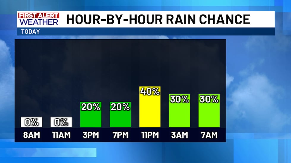
Since the cold front is still hundreds of miles away today, today and tonight’s rain chance is largely due to increasing moisture. From roughly 2 PM Friday through around 5 AM Saturday, we may see widely scattered to numerous spots of drizzle, light sprinkles, or even maybe a thunderstorm or two.
It’s mostly a nuisance rain Friday afternoon and Friday evening, but there’s a chance for a few rumbles of thunder from about 9 PM to 4 AM Saturday. Most of the rain stays light, but any thunderstorms that do form could potentially contain some small hail.
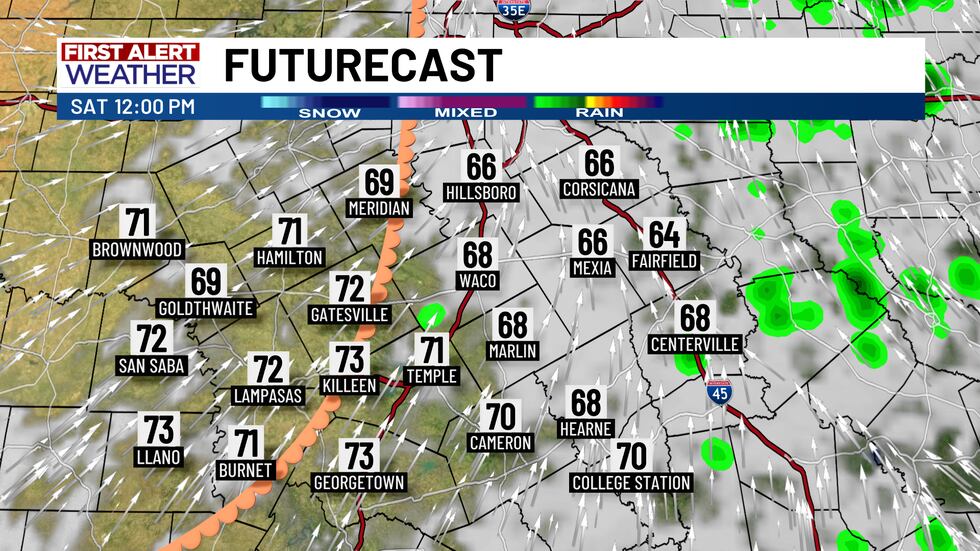
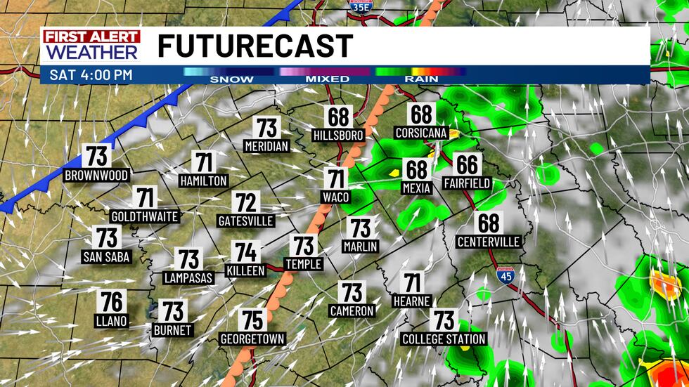
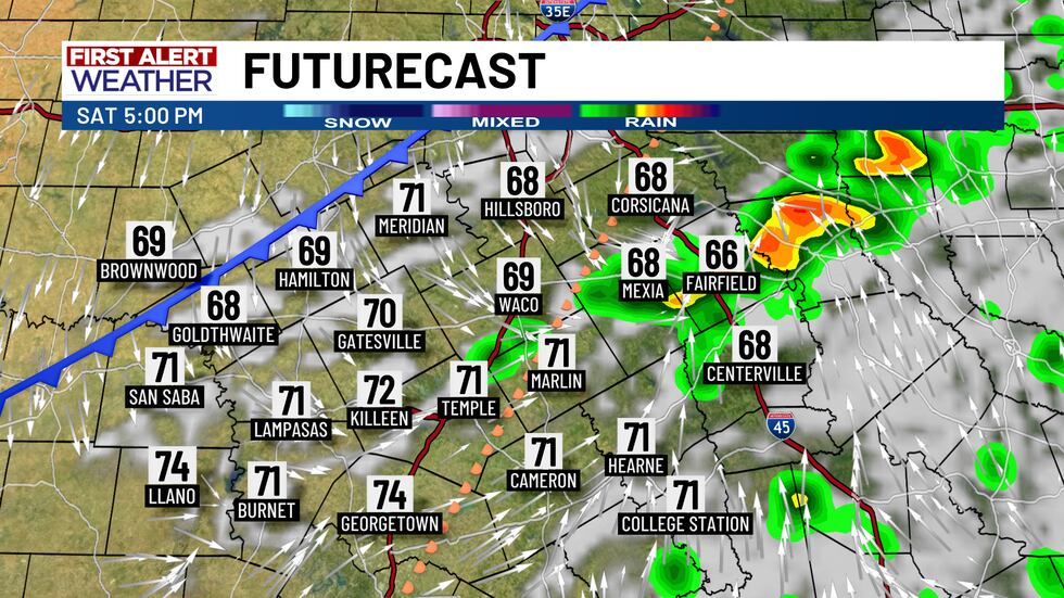
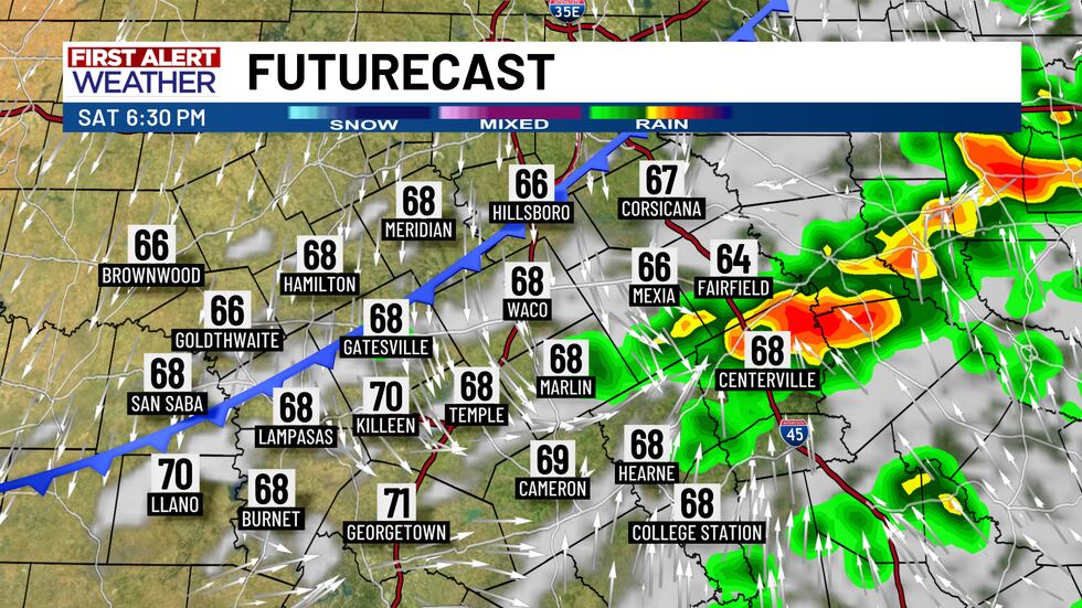
Morning rain departs Saturday by or shortly after sunrise, but storms may return again as the front arrives Saturday afternoon. It’ll mostly be cities and town near and east of I-35 that have the best chance to see storms from 3 PM to 10 PM, but the storms may struggle to either get going or stick around since Saturday’s cold front may move too fast for the storms to get a foothold. Still, any storms that form could contain hail!
Copyright 2025 KWTX. All rights reserved.


