A BIG weather change Sunday with a foggy start to the day today
Despite the fog, it’s going to be a warmer day of weather
Central Texas’ next cold front blasts through Central Texas overnight Saturday into Sunday morning and will bring a BIG but brief temperature change that’ll make it feel like December. Outside of Sunday and Monday, warmer-than-normal conditions will be the norm with highs mostly in the 70s over the next ten days with minimal precipitation opportunities. Even though we may not see much more than a sprinkle or two this weekend, the battle of dry air and humid air gives us a split day of weather today.
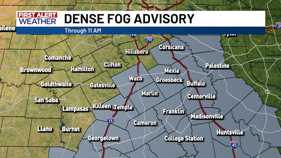
A dense fog advisory is in effect for McLennan, Bell, Falls, Limestone, Freestone, Milam, Robertson, and Leon County until 11 AM. Typically, fog only lingers until mid-morning, but a surge of humidity this morning will keep foggy conditions around for some through the lunch hour. In fact, some spots will actually start out WITHOUT fog by sunrise before fog rolls in near and after 8 AM. The fog may be locally thick with visibility dropping below a mile so drive to conditions and avoid tailgating. Fog should completely dissipate by the lunch time, but thick fog may linger through about 11 AM. The morning fog near and especially east of I-35 means temperatures will be a bit cooler this afternoon as highs settle in the mid-to-upper 60s. The rest of the area with full sunshine through the day will see highs settle in the low-to-mid 70s!
The start of the weekend features vastly different weather from the end of the weekend. The push of cold air doesn’t arrive until overnight Saturday into Sunday morning, but Saturday will still be a cooler day largely thanks to more cloudiness overhead. There’s a chance for a few stray morning sprinkles with out-the-door temperatures in the upper 40s and lower 50s warming into the mid-to-upper 60s. A few 70s could show up, but it all depends on how much sunshine breaks through the clouds.
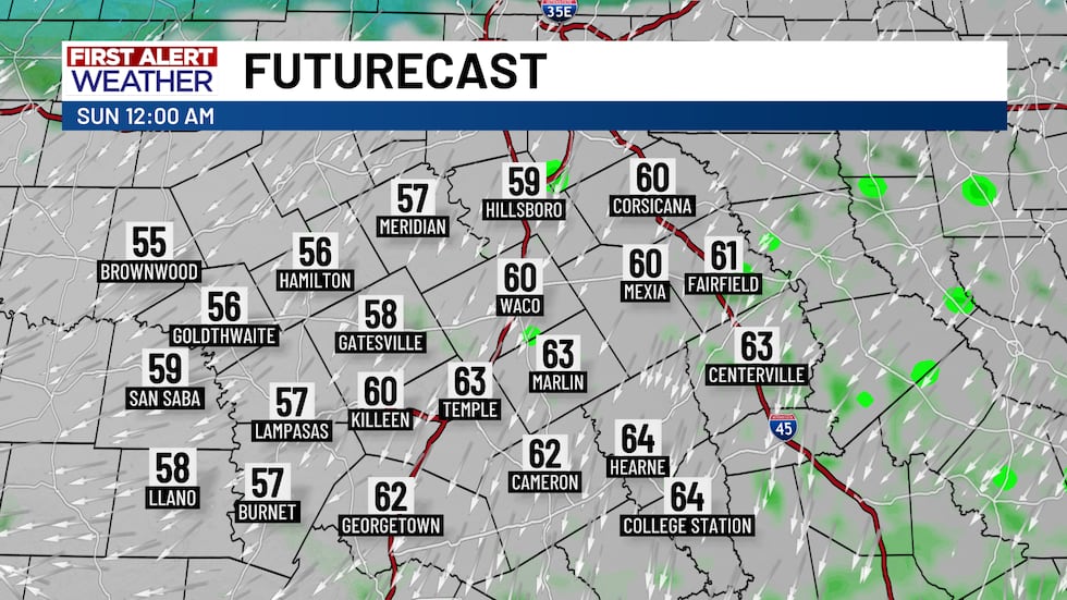
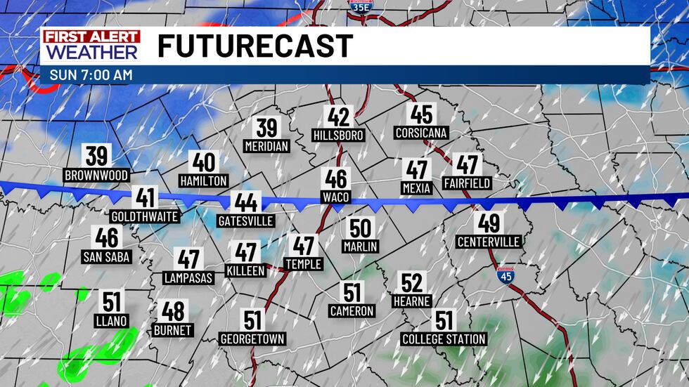
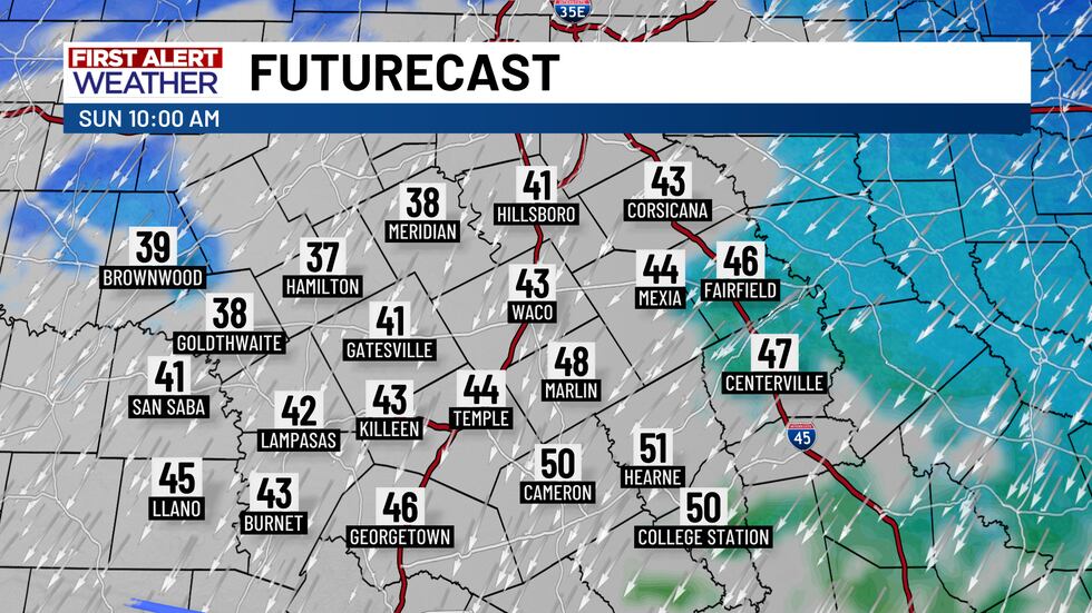
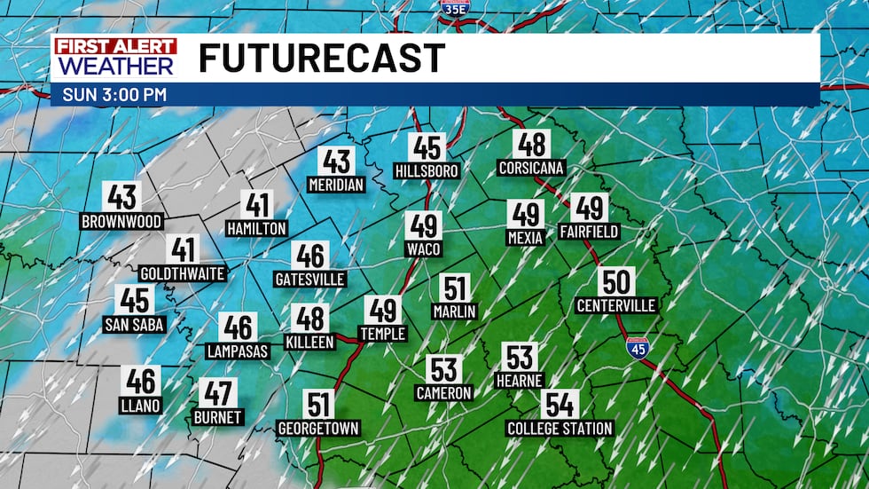
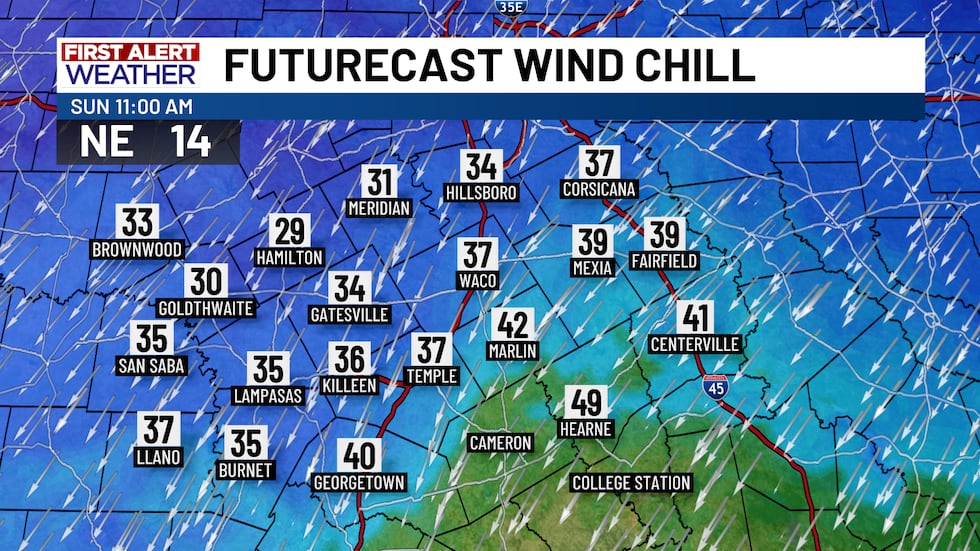
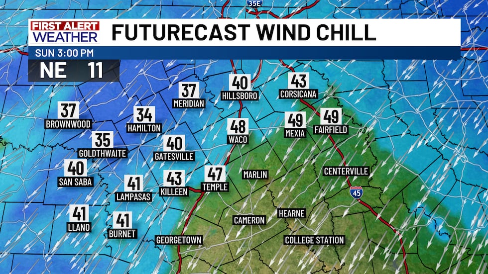
Saturday night will even still be a warm night with temperatures by midnight still in the upper 50s and lower 60s. By daybreak, whoa, Nelly! The cold front blasting through means daybreak temperatures near and north of Highway 84 will drop into the upper 30s and lower 40s while upper 40s and low 50s still linger south of Highway 84. The front will completely clear the area by 10 AM and it’ll be around that time that we see our morning low temperatures in the 30s and low-to-mid 40s. With morning cloudiness giving way to some afternoon sunshine, late day temperatures will rebound into the mid-to-upper 40s and potentially the low 50s in spots depending on how quickly the clouds clear. Don’t forget about the wind, y’all! North winds gusting between 20 and 30 MPH means it’ll feel biting for most of the day. Wind chills through midday will be in the 20s and lower 30s while afternoon wind chills will mostly be in the 30s and lower 40s.
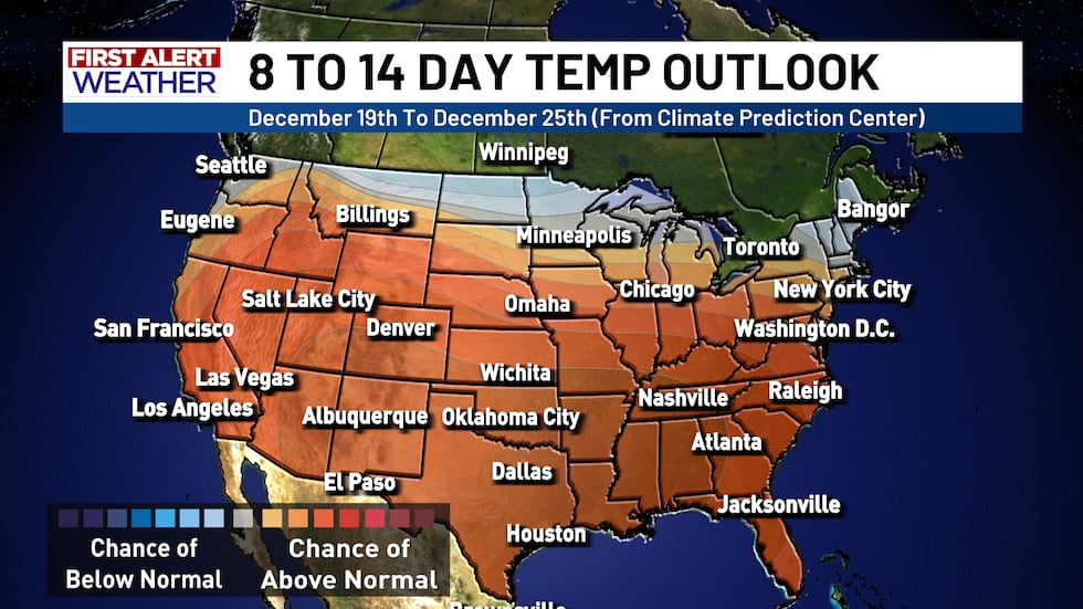
The cold air from the front won’t last for long, but we’re still feeling the chill Monday morning as we’re out the door with temperatures near freezing and wind chills dipping into the 20s. A mix of sunshine and clouds keeps us on the cool side with highs in the mid-50s expected. There’s still an opportunity for rain Tuesday and Wednesday, but rain chances have slipped to a paltry 10% with maybe a few sprinkles showing up near and east of I-35. Tuesday will be a cloudy day as humidity pushes in from the south. That surging humidity will warm us up in a big way as we lead into next weekend. Highs will be in the lower 70s Wednesday, Thursday, and Friday with afternoon highs in the mid-to-upper 70s next weekend! Morning lows will also start out in the low-to-mid 50s. There’s a chance we could push 80° in the days leading up to Christmas.
TOYS FOR TOTS INFO:
Friday, December 12th (Last Day):
- Drop Off Locations:
- KWTX Studios (6700 American Plaza) from 8 AM to 7 PM. Chief Meteorologist Brady Taylor will be collecting toys from 3 PM to 7 PM.
- 6801 West Adams Avenue Walmart in Temple (4 PM to 7 PM) With Meteorologist Sean Bellafiore
- 1400 Lowes Blvd (Killeen Walmart, 4 PM to 7 PM) With Meteorologist C.D. Finley
Copyright 2025 KWTX. All rights reserved.


