Starting to look more like July!
We are transitioning from the very wet first half of July to a more typical hot and mainly rain-free second half of the month. The major story for the next 10 days will be the heat and humidity, but we are watching a developing system in the Gulf that may bring us a few stray showers.
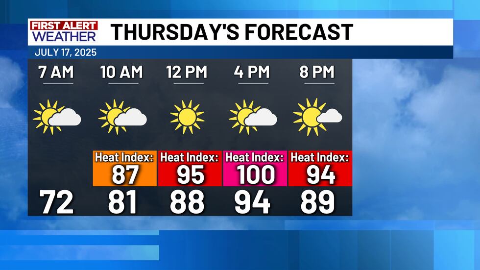
Thursday will be another hot and humid day, but for most of us the afternoon highs will actually stay below our normal high of 97°. The very high humidity rates in place across Central Texas will make it feel like we are around 100° when it comes to the Heat Index values.
We have a small 20% chance for rain in the forecast Friday and Saturday, mainly for our south and eastern counties. We are watching a low pressure system in the Gulf near Florida. The National Hurricane Center has given this area a 40% chance of becoming an organized tropical system over the next couple of days. This system will likely bring some heavy rain across Louisiana, but the vast majority of the rain will remain east of Central Texas.

Next week looks to be hot and humid. High temperatures will get back to near normal in the upper 90s, and we could see heat index values close to 105° much of next week as well!

Copyright 2025 KWTX. All rights reserved.


