Heat & Humidity the Big Story, but Spotty Rain Chances Hold On!
The mid-August heat and humidity remains the big weather story as we end out the workweek and head into the weekend, but we are also keeping slight rain chances in the forecast each of the next few days as well.
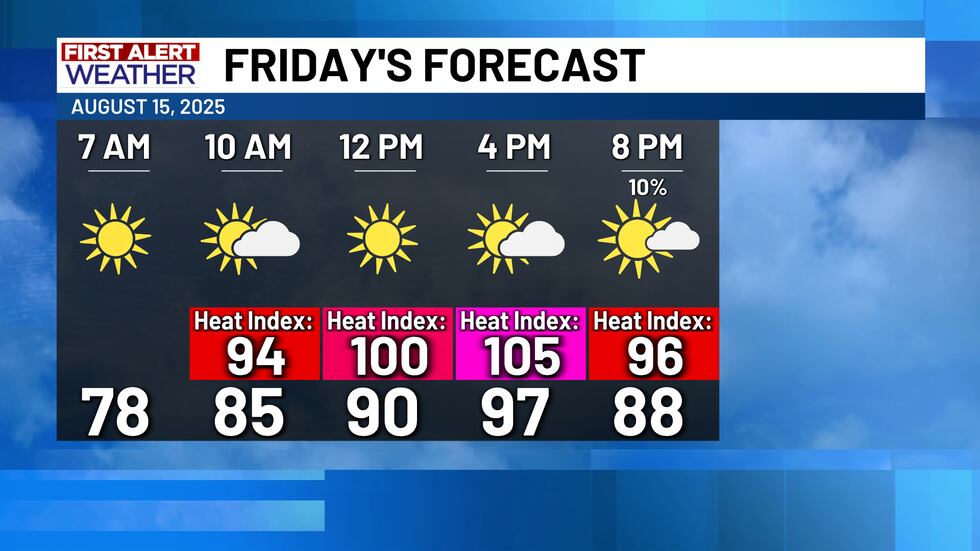
For Friday we will see highs make it into the mid-to-upper 90s, with heat index values ranging between 102-108° in most locations. The highest heat index values will be across our eastern counties, and due to that a Heat Advisory is in effect for Freestone, Leon, and Navarro counties. A few isolated afternoon showers are possible Friday, with the best coverage of rain across our southeastern counties.
The same story continues for the weekend. Highs will be mainly in the mid 90s, but the high humidity rates will push heat index values close to 105°. A few isolated showers can’t be ruled out both Saturday & Sunday, but the rain chances are only around 20%. The spotty rain chances will continue through at least the first half of next week.

A tropical wave moving through the Bay of Campeche into the western Gulf will approach Texas and move ashore Friday. This system only has a 40% chance of developing into a tropical depression or tropical storm, but the Bay of Campeche is typically a hot-spot for quick-developing tropical systems this time of the year. It likely won’t happen, but it’s something to watch. The system will move ashore Friday in either Mexico or Far South Texas. Regardless of development, it’s expected to enhance rain chances along the Texas Gulf Coast Friday and Saturday.
Copyright 2025 KWTX. All rights reserved.


