A few strong storms are possible this afternoon and evening.
Saturday’s outdoor plans could be impacted by a cold front swinging through Central Texas. We’ll all feel the warmth with highs in the lower 90s and heat index values in the mid-90s, but some of us may contend with strong-to-severe storms mainly Saturday afternoon.
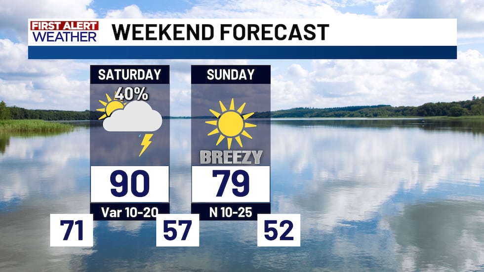
Saturday’s severe weather risk
Fall is Central Texas’ secondary severe weather season, but the incoming cold front likely won’t bring us widespread strong storms.
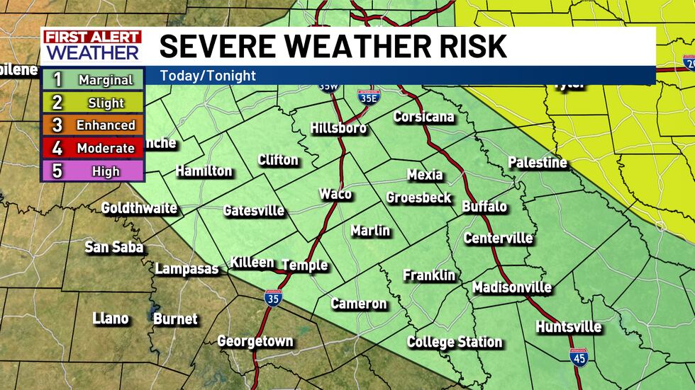
Overall, Central Texas’ severe weather risk is at a level 1 of 5, the marginal category, for much of the area. A level 2 severe weather risk is across Northeast Texas where storm coverage will likely be higher.

The primary severe weather risk stems from strong wind gusts as high as about 65 MPH. The strongest storms could also potentially contain quarter-to-half-dollar size hail as well.
There is a brief window for a tornado between roughly 1 PM and 3 PM Saturday in parts of Robertson, Leon, Freestone, and Limestone County, but the tornado risk remains very low.

Some showers possible by late morning
Saturday’s cold front won’t actually push through the area until the evening and overnight hours, but with the very muggy conditions in place we could see a few showers develop during the late morning hours

As our cold front starts to approach, we could see some scattered thunderstorms develop across some of our western counties during the early afternoon hours.
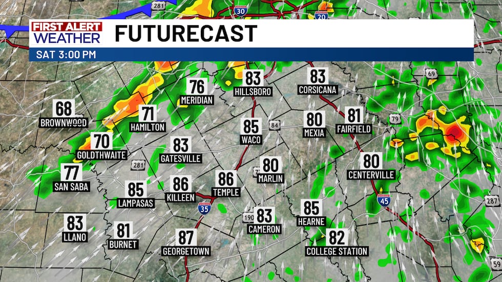
The main storm risk arrives later in the afternoon
The cold front pushes into Central Texas gradually during the afternoon and early evening hours. The best potential for scattered thunderstorms will be during this timeframe. A stray strong storm is possible, but the overall severe risk remains low.

Storm potential will gradually decrease through the evening as the cold front pushes through.

Copyright 2025 KWTX. All rights reserved.


