Storms Moving Out... Cooler Air Gradually Moving In!
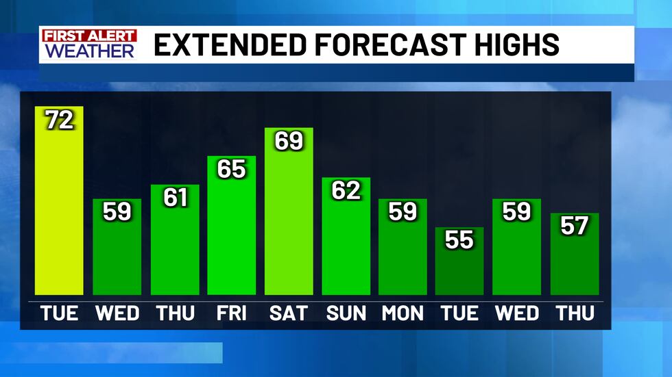
The stormy weather is shifting off to the east, and now we shift our attention to cooler air filtering in. A Pacific front is what is pushing the rain and storms out of our area. Behind this front we will see drier air filter in, but not much in the way of colder air. We will stay most clear and cool tonight, with lows down around 50°. It will be a sunny and nice day Tuesday, with highs in the low 70s. A secondary front, this one actually has cold air to work with, will push through Tuesday afternoon/evening. This front will bring a nice drop in the temperatures heading towards Thanksgiving!
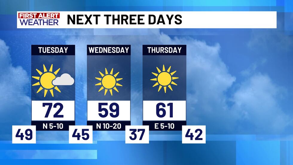
Highs on Wednesday & Thanksgiving day will only make it into the upper 50s and low 60s. It will be a little chilly Thanksgiving morning, with lows in the mid-to-upper 30s for most of us. Overall we will have some very nice weather for the Thanksgiving holiday, but our next weather system looks to bring us more rain chances as we head into the weekend following Thanksgiving.
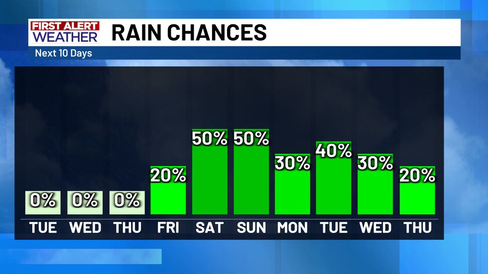
There is some uncertainty with rain chances heading into next week, but as of now we are keeping scattered rain chances around through next Thursday. We are also tracking another push of colder air likely to move in early next week. The latest model data is coming in colder! We have bumped lows down into the 50s for most of next week, but if the current data ends up being true we may have to continue to lower those temperatures.
Copyright 2025 KWTX. All rights reserved.


